Showing posts with label tourists. Show all posts

Thursday, 12 May 2016

Manoeuvre, Mirror, (Maybe) Signal

Driving in Argentina is ...interesting. While not as crazy as, say, Colombia (let alone Asia), we have quickly learnt that things are quite different here than at home. Firstly, normal road rules don't really apply. At roundabouts and so on, the general rule seems to be whoever goes fastest, or is most pushy, has the right of way. And for Argentinian drivers, it isn't the usual mirror, signal, manoeuvre, but manoeuvre first, then have a look in the mirror and signal if you feel like it.

Galloping horse and llama! On the way to Cachi
Secondly, nearly all of the towns in the country (and in fact the whole continent) use a grid system of roads, but there are virtually no traffic lights. So every time you come to a junction, you have to slow down dramatically in case something comes shooting out in front of you. It's quite frustrating! Instead, the authorities opt to put traffic lights at seemingly random places where they are totally unnecessary. We got stopped at 10 different sets on a 5km stretch on the way out of Calilegua, all of them interminably long and completely redundant!

Roads / rivers, from the top of the pass going to Cachi
Thirdly, Argentina is FULL of police checks. We've noticed this on buses before - every so often, your bus will be stopped and police will come on board, search the bus, ask a few people for ID, etc. In the car, we realised just how many police stops there are! Literally every few km there would be police in the road, signalling at us to slow down. On 90% of occasions, they would wave us straight on again just as we'd nearly come to a halt, obviously recognising the standard tourist rental car (everyone renting a car here has exactly the same one - a Chevrolet Classic). We got stopped properly twice, and only once asked for any documents. The silly thing is, they didn't even want to see Kev's driving licence, only the rental car stuff and his passport! We met another English couple who'd shown the police their UK licences and been met with total confusion and asked for their passports instead. It would doubtless have been fine for me to drive then!

One of the many little chapels we passed along the roads in the north
The even more stupid thing police-wise is that at siesta time (roughly 12.30 - 4pm),  and any time after 7pm, the police all shut up shop and the roads are totally clear. It would thus seem obvious that if you were planning any dodgy dealings, you would just need to drive at siesta time or at night. How many drug smugglers, or whatever it is they are looking for, do they actually catch with these checks? We wonder why they bother with all this at all - perhaps it is just to provide lots of people with employment as roadside police officers!

Colourful mountains and lots of cacti! In Los Cardones National Park
Another issue that has made driving interesting, of course, is the road surfaces. A lot of places we've wanted to visit have been down pretty dodgy, unpaved gravel roads. On a couple of occasions, we heard a loud clank and got out, fearing the worst - massive dent, burst tyre, etc. One time we drove through a huge patch of mud, and the mud then gradually dried and came off the wheels, making a continuous spattering noise so we were we convinced we'd got something stuck in the wheel. Another time, we noticed a petrol smell inside the car, and after two days of this thought we must have got a small hole in the petrol tank. We took the car to a mechanic, who said it was just that the petrol tank had been overfilled. Phew. And on our last day with the car, we suddenly noticed two little clear marks, like water drops, on the windscreen, that weren't coming off with the windscreen wipers... Alarm bells rang - we were convinced we'd managed to chip the windscreen! Fortunately, when we got out to look, we discovered they were in fact just some tree sap that we could clean off. Big relief! The car is being picked up today, and as far as we can tell has survived its time with us unscathed. Let's hope the rental company agrees.

Pretty butterfly in Calilegua National Park
Enough about driving. What about the places we have visited in our last few days with the car? When Kev last wrote, we had just left the spectacular Quebrada de Humahuaca region, in the far north. Our next stopping point was Calilegua National Park, down at only 600m altitude and a totally different climate to the cold and aridity of Humahuaca. Calilegua encompasses a large, protected region of cloud forest and we had been looking forward to some hiking there. But alas, when we got to the national park, only 4 of the 10 hiking trails were open. The rest, including all of the longer ones, had been closed due to flooding a few weeks ago. We were disappointed, but made the best of things by doing a short walk linking together a couple of the trails that were open. Calilegua is a haven of biodiversity, especially with respect to birds - there are over 250 species here, and birdwatchers come from all over the country.  We heard plenty of birds, but saw very few in the park itself. Ironically, we saw more birds in the town that is the base for the park - several toucans and parrots in the trees!

Cactus filled plain and colourful mountains, in Los Cardones National Park 
From Calilegua, we drove all the way back down to Salta, and spent a night there before continuing on to the small village of Cachi, out to the west on the way to Cafayate via the scenic route. This was mostly along a paved road, luckily, with only 20-30km unmade. The road wound up to a 3500m pass, through fantastic scenery that began quite green and became more arid and desert like as we got higher. We passed through Los Cardones National Park, named for the Cardón cactus, of which there were loads! At one point it was just a huge plain, covered in cacti, and framed by the mountains in the distance. Pretty cool. Other parts of the journey took in some quite volcanic looking landscapes that reminded us of Pali Aike National Park in Chile.

Little cemetery in Cachi
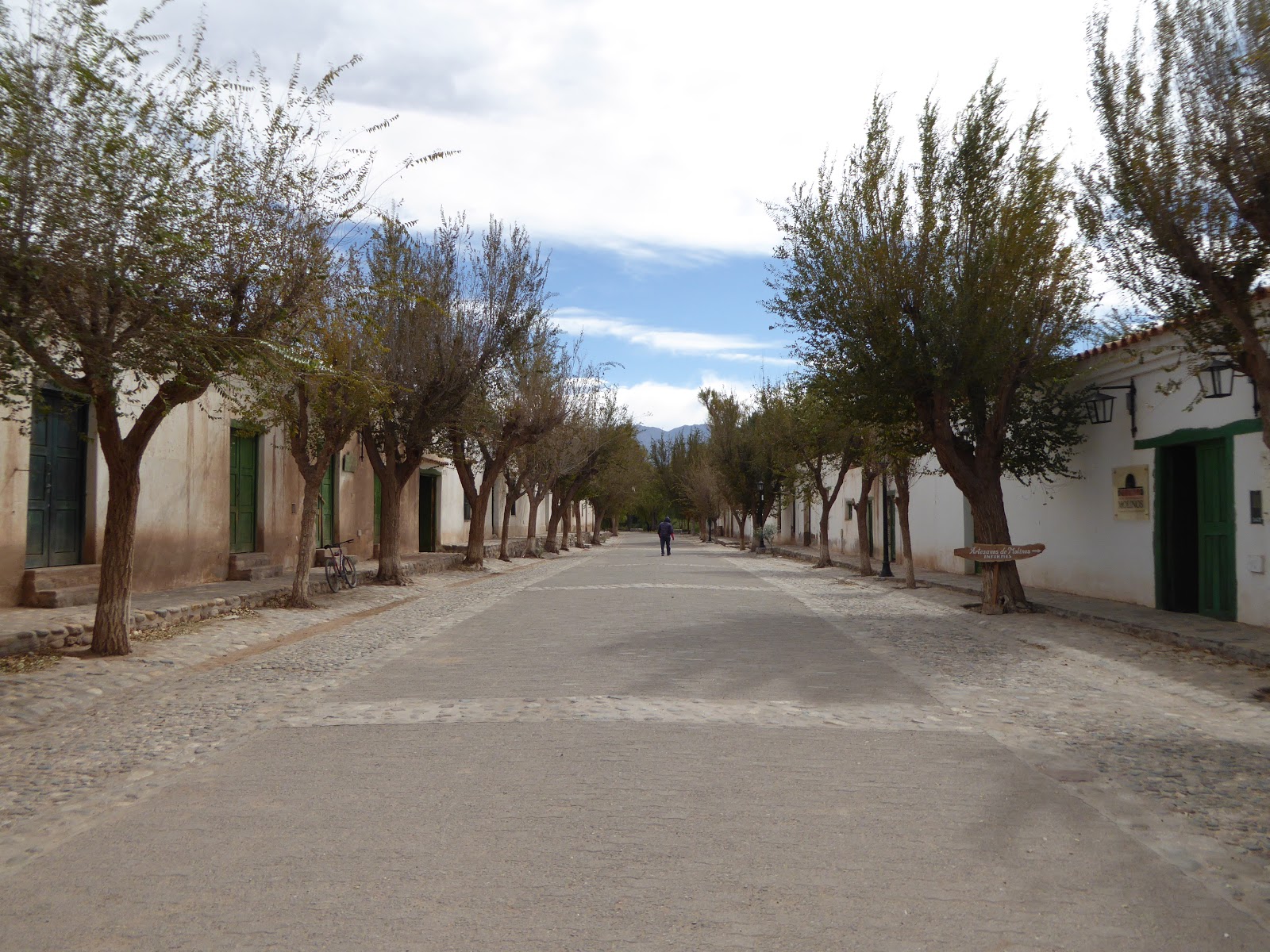
Cachi itself was a very pleasant little village, extremely quiet during low season. I think we met most of the (5 or 6) tourists there on the first afternoon as we strolled around the centre! It's hard to say what was so great about Cachi, but we really liked it - it had an amazingly relaxed, sleepy feel, as well as being very pretty with its traditional adobe buildings and lovely little square. We didn't do much there, other than a couple of walks, one to get a view of the subdued, purple coloured mountains behind the village, and the second to a nice viewpoint of the village itself. It was beautiful seeing the bright green squares of some of the fields of crops down by the village, against the barren backdrop of the hills all around.

Pretty avenue in Molinos, en route from Cachi to Cafayate
In Cachi we met an older English couple on holiday, bemoaning the terrible state of the road from Salta. We didn't dare tell them that the roads got a lot worse in the north! We met them again in another small village, Molinos, the next day, on the way south to Cafayate. This trip from Cachi to Cafayate looked on the map like it wouldn't be too arduous - it was roughly the same distance as from Salta to Cachi (160km). However, we hadn't quite realised just how bad the road was. This was 160km down the Argentina's famous Ruta 40, which stretches all the way down the west of the country, nearly 5000km in total. We'd read plenty of horror stories about Ruta 40 when we were in Patagonia, but been pleasantly surprised - most of the road down that end had been paved since our guidebook was published.

On Ruta 40 heading towards Cafayate
Sadly, the same could not be said about this end of Ruta 40! While the road began in not too bad a state, it got progressively worse after we met the English couple again in Molinos, which is about 40km south from Cachi. The middle 60km or so of the road was dire. This was the section where we heard several loud bangs and feared the worst, and where we got mud all over the car! We actually passed a machine that was meant to be flattening the road surface, but all it was doing was pushing all the sand and stones into a heap in the middle, forcing you to remain on one side of the road at all times regardless of how bad it was.  Hmm. Still, the state of the road was mitigated by the absolutely breathtaking scenery, and eventually we made it to Cafayate, in a total of 6 hours. Everyone else we'd met in Cachi had also survived the road with their rental cars, so things could have been a lot worse!

Crazy rock formations along Ruta 40
Cafayate is famous for two things - wine, and a spectacular canyon (the Quebrada de las Conchas). We duly took advantage of both these things. On our first full day Kev had a break from driving and we spent the afternoon winetasting. Sounds idyllic, but was actually a little frustrating! We went out at around 1.30pm, and found ALL the wineries in town were closed for siesta until 3 or 4. The Argentinian siesta is a bit of a joke - it happens everywhere in the country, regardless of the weather (it's about 15 degrees in Cafayate at the moment) and regardless of any thought for business. Cafayate is a very touristy town, the tourists come to visit the wineries - but do they think to open the wineries all day? Nope. Only 10-12am and 3-5pm. They must be missing out on a ton of business.

El Esteco winery in Cafayate
We did eventually make it to 3 different wineries later in the afternoon. The wine here is excellent, especially the Malbec (for which Argentina is famous, obviously) and the Torrontés, a white grape variety we'd not come across before. The wine tastings though, were less excellent - the people working at the wineries clearly didn't care in the slightest about our being there. There was no enthusiasm, no information, no anything really! Just 'here's your wine, drink up'. There was also a bit of a lack of knowledge. We were sampling a Torrontés in the first winery, and I commented that it was quite dry and tasted similar to a Sauvignon Blanc. The guy looked confused, and, I kid you not, said that he had never heard of Sauvignon Blanc, and the only white wine they made there was Torrontés. How can you work in the wine industry and not have heard of one of the most famous varieties of white wine worldwide?! Pretty funny, we thought.

Pretty scenery our hike near Cafayate
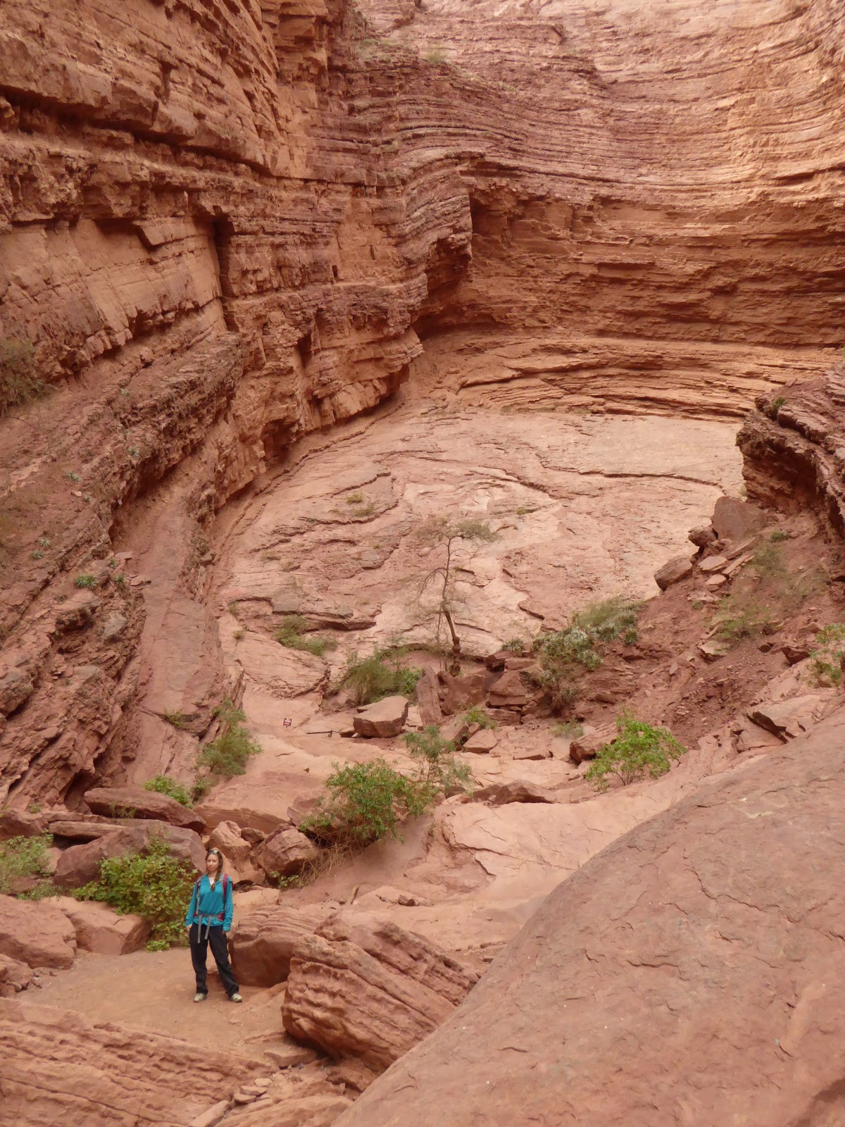
We also did a nice hike a few km out of town, up a small canyon passing several waterfalls. It was great fun - more of a rock climb in places than a walk! We were advised to get a guide, but decided to go it alone and enjoyed it all the more for the challenge of trying to work out where the path went. We also drove through the big canyon, the Quebrada de las Conchas, admiring the otherworldly landscapes. The scenery round Humahuaca was unbelievable, but this was equally so! Amazing formations of red sandstone, looking so much like slightly eroded pillars, pinnacles and other man-made features that it was hard to believe they were natural. The highlights were two huge hollows carved out of the rock, with layers upon layers of twisted rock forming two massive spaces like amphitheatres. The acoustics were incredible!

The Garganta del Diablo formation, in the Quebrada de las Conchas
We are still in Cafayate, planning to do another wine tasting or two today before we head south tomorrow. Where to is still to be decided. The problem is that none of the buses from Cafayate go where we want to - so we are going to have to rethink our route a little. We are still ultimately aiming for Mendoza, where we hope to reunite with our London friends Ralph and Shehnaaz in the next week or two.

Another lovely view in the Quebrada de las Conchas

Sunday, 1 May 2016

Why Does Nobody Go To Paraguay?

Paraguay is not somewhere you hear much about when travelling South America. Most people seem to skip it all together, or perhaps just go across for the day from Argentina or Brazil for a cursory country grab. Neither Lonely Planet or Rough Guide even bother to produce a guide for Paraguay - it gets a short mention in the Lonely Planet Shoestring guide that covers the whole continent, but that's it. So unlike most places we've been, we really didn't know anything about this country before we arrived, or have any idea what to expect of it.

Sunset in Encarnación
Paraguay is a landlocked country, bordering Bolivia, Brazil and Argentina. It is home to an amazing variety of different environments and habitats, including the Chaco, the Pantanal, and Atlantic rainforest. A lot of the country is still relatively untouched wilderness, and there are many conservation projects trying to limit deforestation and protect its rich biodiversity.

Street in Asunción
We had hoped to do more than the average tourist in Paraguay and get off the beaten track a little: we'd read that this is difficult to do, but dismissed this as hyperbole. However, once in the country we found that the reports were more accurate than we'd imagined! Paraguay really isn't particularly bothered about attracting tourists so there is very little tourist infrastructure and it is hard to find accurate information about anything other than the urban centres.

The Chaco region, a semi-arid area rich in wildlife, makes up more than 60% of Paraguay's land area, but less than 2% of the country's population lives there. We had wanted to explore this region, but as it so sparsely populated it is somewhat challenging to get around. The Pantanal, a wetland region on the border with Brazil, is also something of a mission to get to. We met an Australian at our hostel in Asuncion who was trying to go there - his journey would involve a 7 hour bus, a public boat for 3 days, and then having to hire another boat himself for the final section. Maybe earlier in our trip we'd have been up for this, but this late on we are trying to push on to see as much of the rest of the continent as we can in our last few weeks.

Lake view from Aregua, near Asunción
What we did think would be feasible was visiting one of the country's protected areas of Atlantic forest, the San Rafael National Park and Reserve. This is only a 3 or 4 hour journey from Encarnación, and we had already managed to get in touch with staff at the park and provisionally booked a cabin for a few days. However, when it came to our planned day of departure, circumstances conspired against us. The night before, the horrendously hot and humid weather (39 degrees!) finally broke - there was a big thunderstorm and it rained all night and was still pouring the next morning. The road to San Rafael is unpaved and often becomes impassable in bad weather. We managed to phone the park from our hostel, and were told it would be impossible to go that day. We stayed another night in Encarnación and hoped that the weather would brighten up enough to dry the road by tomorrow. Alas, the downpour continued all day, and park staff told us the next day that the road was still impassable. We really wanted to go, but the forecast wasn't good for the rest of the week either, so we reluctantly gave it up as a bad job and got on a bus to Asunción.

Ceramics for sale in Aregua, near Asunción
About an hour into the journey to Asunción, we went through the small town of Coronel Bogado. We remembered the name from something the friendly old lady at our hostel in Encarnación had said to us - that the best 'chipas' in the country are made there. Chipas are dense, baked rolls made from maize and flavoured with Paraguayan cheese. They are quite an institution in Paraguay and the neighbouring area of Argentina - street vendors carry baskets of them in all sorts of shapes and sizes. When the bus stopped in Coronel Bogado, a couple of sellers got on, and we knew this must indeed be the famous place as literally all the locals on the bus bought some! Obviously we did too, and they were the best we had anywhere. Yum. Another interesting part of Paraguayan culture is the tereré - like Argentinian maté tea, but served cold. Most locals constantly carry around large water flasks in special carry cases with a pocket for their tereré cup!

Palacio de Gobierno, Asunción
Despite being the Paraguayan capital, Asunción doesn't have a lot to see or do. We dutifully spent an afternoon wandering around the centre, but weren't very taken with any of the sites other than the Palacio de Gobierno, an impressive, large colonial building painted pale pink. We thought this was a lot prettier than the famous Casa Rosada in Buenos Aires! The city has bit of a feel of faded glory - there are quite a lot of old buildings but most are very dilapidated and little or no effort has been made to conserve them. Asunción is actually one of the oldest cities in South America, founded in 1537, and in colonial times it was also one of the most important. Since independence however, and after the Paraguayan war in the 1860s, the city lost its importance and the national economy has declined rapidly. The war, also known as the Triple Alliance war (Paraguay against the combined forces of Brazil, Argentina and Uruguay) had a massive impact on Paraguay. It was one of the worst military defeats ever inflicted on a nation - more than 60% of the population died, and 90% of the country's men. Really, Paraguay is still struggling to recover from the effects of the war today.

Modern and old combined, in a courtyard in Asunción
Asunción is built on the Paraguay river, and  few months ago it was hit by some of the worst floods in decades, which you might have seen on the international news. Tens of thousands of people were displaced from their homes, and sadly it seems many of them still have nowhere to live. We walked past a huge, makeshift camp or shanty town, with hundreds of people living in wooden shacks or just tents made from bin bags with no sides. The camp was in one of the city's biggest plazas, right on the doorstep of the presidential buildings - maybe to make a point, as the government is apparently doing little to help. It was sad and quite shocking to see.

Riverfront and very cool sky in Corrientes
We met no other tourists in Encarnación, so were surprised to find a really excellent, sociable hostel in Asunción (El Nomada). We spent a lot of time just hanging out there and chatting. Most people travelling Paraguay are not your ordinary tourist, and we met some great people, including a couple of bikers who'd been travelling the world with their huge bike and sidecar for three years! We also went with another English guy we met to a nearby town, Areguá, which is famous for its ceramics. We reluctantly left this fantastic hostel after 3 nights and embarked on another long bus ride (8 hours) back over the border to Argentina and the cities of Corrientes and Resistencia. The weather had been fine for the previous two days, but a little like our last night in Encarnación, there was a big storm the night before we left Asunción. The temperature dropped literally 20 degrees in a day. After being at temperatures well above 30 degrees for several weeks, 10 degrees was quite a shock! We had to dig out our coats and jumpers again that we'd thought we'd not need for the rest of the trip.

Monastery in Corrientes
For the next couple of days, we stayed in the Argentinian city of Corrientes, the capital of the Corrientes province. It is only a 20 minute drive away from the neighbouring city of Resistencia, across a river which marks the border between provinces. So, strangely, Resistencia is also the capital of a province - the Chaco province! We liked both of these cities as they were just typical Argentinian cities, with no tourists. The locals were super friendly and whenever we sat down in a cafe we'd get engaged in conversation by people curious to see us there! Corrientes is the more historic of the two, while Resistencia is known as Argentina's 'Capital of Sculptures'. Every 2 years the city has a competition that sculptors come from all over the world to take part in - they have 7 days to produce a sculpture. The best ones are displayed either in the museum or on the streets - more than 200 line the streets in the centre already.

Sculptures in Resistencia
From Corrientes we took our first night bus since Colombia - 13 hours up to Salta in the north of Argentina. We had forgotten how expensive buses are in Argentina - £45 a person! We are looking forward to exploring more of this area now, and probably hiring a car.

Sunday, 10 April 2016

Rio de Janeiro

A horrendous set of flights took us from French Guiana to Rio. We left Cayenne at 5:30pm in order to spend 8 hours in the airport in the northern Brazilian city of Belém. We left there at 3am for Belo Horizonte before a final, hour long, flight to our destination. It seems that this is common in Brazil - our later journey to Foz do Iguaçu would also require three flights.

Rio from Corcovado
Rio is a beautiful city, best seen from its many heights. Or from its beaches. Or from street level. We shared our time between all of these, hitting all of the major sights - Sugarloaf Mountain, Christ the Redeemer, Copacabana, Ipanema... It's strange to be in a place where you already know all of the names and sights, but this doesn't detract from the experience at all.

Copacabana Beach
Half of the city is set along Guanabara Bay and the rest along the Atlantic coast. We walked down from the hilly Santa Teresa area, where we were staying, to Flamengo beach where we received our first view of the classic Rio scenery. A long, lively beach filled with people playing beach volleyball and football, sloping down to the bay and the distinctive hills on the other side. Around the corner is Copacabana beach, and we climbed the hill at the end to Leme fort. There were great views of the sweep of the beach, but also to Sugarloaf on the other side. Copacabana is separated from Ipanema beach by a headland, and we spent several evenings sitting on the bare rock here to enjoy the sunset.

Sunset over Ipanema Beach
Although we enjoy walking, it's not possible to get to the top of Sugarloaf without rock climbing or taking the cable car. We took the cable car, first to the accompanying hill Morro de Urca, then to the top of Sugarloaf itself. Unfortunately, we'd picked a day when the top was covered in cloud. No matter - the sunset views from Urca over Botafogo and Guanabara Bay were spectacular, and Sugarloaf was lit beautifully.

The cable car to Sugarloaf Mountain
Most people ascend Corcovado to visit the iconic art deco statue of Jesus by train or minibus, but we'd heard that it's possible to walk up. We started in Parque Lage and made our way up the 700m ascent, which got gradually steeper and slipperier. At one point we had to use a chain pinned to the cliff to get up a particularly precarious part. The effort was worth it - the views at the top over the whole of the city are unmissable. We took the train down.

Worshipping at Christ the Redeemer
Rio is currently preparing to host the Olympics and, therefore, is busy building and renovating everything. From what we saw, there will be plenty that is pushed right up to the wire. There are some new trams being prepared in the city centre, but the tracks are still being laid; and some buildings (the National Library, for example) were receiving facelifts, but political infighting has led to all work being stopped. This has left important parts of the city's architecture covered in scaffolding and sheets for one of its biggest events.

Olympic City sign next to Rio's newest museum, the 'Museum of the Future'
On many of the hills, and integrated with the rest of the city, are the favelas - inner city slums. There are lots of companies offering tours in many shapes and forms, but we decided against any of them. We're sure that many of the companies operate very ethically, but there are plenty that don't as well. Because of the tight integration of the poorer areas, Rio can be quite a dangerous city. We were followed by some assumably unsavoury characters after leaving a bank (ironically which hadn't worked with our card), but we shook them off by wandering around a supermarket for a while. We also heard a lot of firecrackers going off, which are often used as signals by the drug gangs. These were the only times when we felt unsafe, though.

Sunset from the Morro de Urca over Botofogo
We've now left Rio on our second batch of Brazilian flights to Foz do Iguaçu, to see the Iguazu Falls. They have been on top of my list of things to visit for a long time, so I'm excited to finally make it there.

Monday, 21 March 2016

A Very Smelly City

We departed Curaçao late in the evening, after a great few days there. As we mentioned previously, one of our main reasons for visiting was to use it as a stop off point between Colombia and Guyana, thus avoiding Venezuela. We found there was a cheap daily flight from Curaçao to Georgetown, the Guyanese capital, with InselAir.

Georgetown, viewed from the air
What we didn't realise when we booked this flight, was how notoriously bad InselAir is. As it is one of the only carriers offering short hops around the Caribbean and the north coast of South America, it has a bit of a monopoly. It seems this means it can run its flights whenever it wants, and the scheduled times mostly bore no resemblance to the actual departures!  Our flight was meant to leave at 9:30 pm, the last of the evening from Curaçao. It actually went at 11:10 pm, from a different departure gate. The time and departure was announced suddenly - up till then we'd heard nothing about it. We were quite fortunate it seems, as three other InselAir flights scheduled to leave before ours had not even arrived when we were boarding. Art, our host in Curaçao, told us the InselAir flights are always like this!

St George's Cathedral, in Georgetown
Anyway, we eventually arrived safely in Georgetown at 1am. We had been a little worried that our taxi pick up would not be there, or the driver would be an axe-murderer (safety is quite an issue in Georgetown, especially late at night). However, all went smoothly. Other than the fact that the airport is not in fact in Georgetown but out in the jungle nearly an hour's drive away... hence it was full of moths. BIG ones. Like, the biggest moths I've ever seen, all at once. It was a complete nightmare for me, and when we got in the taxi and there was one inside, I nearly had a heart attack! Luckily, once in the city, moth sizes / numbers became a lot more manageable.

Interior of St George's Cathedral
Guyana is probably the least well known and the least travelled country in all of South America. This little nation, with a population of only 750,000 people, used to be a British colony and only became independent in 1966. The British influence is evident in several respects: the official language is English (it's the only country on the continent that speaks English as its first language), they drive on the left hand side of the road, they are passionate about cricket, and they are fond of tea (in teapots). Oh, and the local beer, Banks Beer, first brewed while Guyana was still a British colony, is probably the best national lager we've had in South America. The country is also very multicultural - another legacy of the British, who brought slaves over from Africa and indentured labourers from India. The largest ethnic groups today are East Indian and African. It is the poorest country in South America, behind Bolivia and Paraguay, and the local currency is the Guyanese dollar, of which there are about 300 to a pound. It's quite entertaining when you hear that your dinner will be 1000 dollars! Given that it is so poor, it seems strange how expensive it is - just a few days here will severely dent a backpacker's budget, we found out.

The City Hall in Georgetown
When we arrived in Georgetown itself, the first thing that hit us was the smell... not in a good way! The city has open sewers, is very dirty, and all water channels / rivers are literally black. Everywhere stinks of poo. However, we got used to this fairly quickly! Georgetown also has a reputation for being unsafe, as I mentioned - there is a high incidence of petty crime and certain areas are definite no-go zones for tourists. We were a little nervous at first to just walk around on our own, but our host said it would be fine, so we spent a lot of time just strolling round the city absorbing the atmosphere. We had no problems at all; in fact. on the contrary, people were mostly pretty friendly and curious to see white faces. While Georgetown has quite a gritty feel to it, we enjoyed it, as it is just so completely different to anywhere else in South America. It was great seeing Asian shops everywhere, hearing English spoken (albeit in a Caribbean accent we often couldn't understand!), watching cricket with locals, and hearing Indian-influenced styles of music.

The 1763 Monument, in Revolution Square
We explored the city over 2 days. There aren't many attractions, but the huge wooden cathedral, St George's, was quite impressive. It is apparently the largest wooden church in the world - the locals are quite proud of this! We also visited the City Hall, another colonial wooden structure, decaying somewhat but still very nice; the National Library; and the National Museum. The museum's main exhibition was about Guyana's big festival here, Mashramani, which takes place in February every year to commemorate the anniversary of the country becoming a republic. The photos and costumes on display, and the excitement of local people when discussing this, suggested this country does have one thing in common with the rest of the continent - it loves its carnival! Another day, we walked over to Revolution Square, where there is an interesting African themed memorial to a slave revolt that took place here in 1763. Passing the Botanical Gardens and Zoo en route here we randomly saw two beautiful macaws flying right overhead, reminding us just how close to the jungle Georgetown really is.

Old fashioned adverts lining Georgetown's sea wall... They even had a Marmite advert!
We had planned to go straight from Georgetown over the border to Suriname. Suriname is the only country for which we need a visa - well, a 'tourist card' for us as UK citizens. The process of applying for this was a little complicated. First we had to go to the Surinamese embassy, which was cunningly concealed in a posh residential area of Georgetown. We spent a while walking around looking for it, and eventually located it with the help of some locals. The security guard at the embassy asked us, did we have a photocopy of our passport photo pages? Forewarned about this, we said yes. Did we have a photocopy of our Guyana entry stamp page? Erm, no. Did we have 35 US dollars each? Erm no, but we had $25, which was what it had cost last week. The lady packed us off to change some more Guyanese dollars into USD, and get the other photocopy. We later found out the charge for the tourist card had gone up only 2 days ago - doh!

Aerial view of the jungle near Kaieteur Falls
When we returned to the embassy with all we needed, the security lady finally let us into the office itself. The lady at the desk there told us we'd need to leave our passports and come and pick them up again that afternoon. We couldn't do that, we said, as we had a tour booked that afternoon. We asked if we could come back the following morning instead (Friday). Well, the office MIGHT be closed, she said, as there MIGHT be a national holiday. Could she find out, we asked. No, no-one knew, apparently. There were some local elections happening and the embassy staff didn't yet know if they'd be working or not! We grew steadily more frustrated as we knew the embassy would definitely be shut at the weekend. Eventually we pestered her enough that she managed to get our tourist cards issued straight away! Not sure why you normally have to wait until the afternoon...

At Kaieteur Falls
The reason we couldn't go back to the embassy that afternoon was that we had booked ourselves on a trip to Kaieteur Falls, perhaps Guyana's most spectacular natural attraction. The majority of the country is pristine jungle (well, with the odd gold mine), and the Kaieteur waterfall is deep in the interior, hidden in the rainforest. The only option for getting there, other than a 5 day hike, is a short flight in a small 12 seater plane. It was an expensive tour, but 100% worth it! We flew for an hour over a sea of trees, seeing nothing but this huge expanse of green for miles and miles, interrupted only by the muddy brown rivers snaking their way across the country. As we neared our landing point, the pilot made a big turn, and we had our first sight of the Kaieteur Falls. Wow!

The beautiful Kaieteur Falls
We landed at an airstrip literally in the middle of the jungle, and had 2 hours on a guided walk that took us to three different viewpoints of the falls. It has to be one of the most spectacular in the world, not just for its size (the highest single drop waterfall in the world) but for its stunning setting. The waterfall drops from a rocky outcrop, and all around is rainforest. The power of the water was incredible, even though our guide told us it was currently only about 60% full due to the recent dry weather. In the mist around the falls we could see rainbows. I'm so glad we made it here, as it was really something special. We didn't want to leave, and wished the other tourists who accompanied us on the flight would stop taking photos occasionally so we could just gaze in peace for longer!

Rainbows in the mist
While there is doubtless plenty more to see and do in Guyana, chiefly jungle-based adventures, we are trying to push on through these three little countries at the top of the continent. The prices here are high, and we still have a lot more to squeeze in before we return home in June. So for now, it's goodbye Guyana, as we head on to Suriname (a gruelling 12 hour bus-boat-bus-bus journey, more on that next entry!)

View down the valley from the bottom of the falls

Tuesday, 15 March 2016

Curaçao Drinking in Curaçao

In order to skip the dangerous Venezuela, we found the cheapest flight to Guyana would go via the Dutch island of Curaçao. We decided to spend a few days there to do a few dives and drink the famous liqueur. We also discovered that the main town, Willemstad, is a UNESCO world heritage site!

We didn't get any diving photos, so here's one of a beach instead
The dives here were great - we were collected by the guys that run Scubaçao (unfortunately not pronounced Scuba-Cow) and driven around to the dive sites. It made a nice change to be able to just walk off the beach and dive straight away without having to take a boat. The visibility was amazing, around 30m, and there was plenty of healthy coral, lots of different fish and even some turtles. The best site was probably the one called 'Tugboat' - named after a tug that sunk there when a ship dropped an anchor on it. It is now home to several schools of fish and was fascinating to swim around.

The colourful waterfront in Willemstad
When we weren't diving, we walked around the old city, which was founded in 1634. It spent much of its life as a slave trading port, and there are a couple of good museums dedicated to that awful subject today. The slave trade, the proximity to Spanish-speaking Venezuela, its status as part of the Netherlands and today's tourism has led to an interesting mix of cultures. The local language, Papiamentu, is a combination of Portuguese, Spanish, Dutch and English and we found it strange to be able to pick up words of it here and there.

The Queen Emma floating bridge across Willemstad harbour
Willemstad is now home to a unique floating bridge across the harbour entrance, which swings open when a ship needs to pass. Often, those ships are cruise ships, and the island is full of people supping cocktails made from the local blue curaçao liqueur. From our experience, it's used to make rather sickly blue-green cocktails that pack quite a punch.

Cocktails!
We're now recovering from our hangovers and flying back to the mainland, to Guyana.

Saturday, 12 March 2016

Golden Showers - Well, Gold and Showers

We had enjoyed our time in San Agustín and Tierradentro as they're a little further off the gringo trail (especially Tierradentro). However, now it was time to head firmly back into tourist central - Bogotá, Colombia's capital. We took a nightbus from San Agustín that arrived at 5am, and spent a lot of time drinking coffee until we could check in to our AirBnB later on. We'd chosen to base ourselves in the historical district, La Candelaria, which is where most of the attractions are, and the AirBnB was great - run by a very friendly French-Colombian family.

The main square, Plaza de Bolívar, in Bogotá
So, Bogotá. Bogotá is big.Very big. In terms of population, it is the fourth largest city in all of South America and the second largest we've been to behind Buenos Aires, with nearly 10 million people. It is also high, at about 2650m - the third highest capital city in the world after La Paz and Quito. And based on our experience, Bogotá is also rainy. It rained every day while were here, including some enormous thunderstorms that flooded some streets and caused delays at the airport when the control tower was struck by lightning! The weather liked to fool us by appearing beautifully sunny every morning. Thus without fail we'd say, 'shall we take the raincoats? Nah, we won't need them.' And without fail we'd get soaked. Apparently this much rain is unusual for the time of year, and probably due to the El Niño phenomenon.

Incredibly detailed figures in the Gold Museum
There's plenty to do in Bogotá, and we duly visited the majority of its major tourist sites. One of the highlights was the Museo de Oro (Gold Museum), which is one of the best museums we've been to in South America so far. It tells the history of gold in Colombia, focusing on pre-Columbian times and explaining how gold was obtained, what was made with it, the indigenous mythologies surrounding it, and so on. There were plenty of stunning gold items on display, some dating from over 2000 years ago yet incredibly complex, intricate and beautiful in their designs.

Street art on the graffiti tour
Aside from the Gold Museum, we spent one morning doing the popular graffiti tour around La Candelaria and the city centre. This was quite interesting but the group was huge - over 30 people! - and the guide focused more on the artists' styles than on the actual content / meaning behind the street art. We'd have liked to know WHY a given artist had chosen to portray a toucan with a halo, rather than how he'd done it! We also took the cable car (so many cities in South America have cable cars!) to the top of Cerro Monserrate, up at 3100m. The view of the city was quite nice, but sadly the clouds rolled in, the vista deteriorated extremely quickly and the torrential rain began anew. Another day we visited the Police Museum, which included quite a lot of interesting information on the hunt for Pablo Escobar in the early 1990s. On display there was even a desk Escobar owned, which on first sight looks normal, but when kicked in a certain way reveals a false back and false bottom, with several secret compartments. There was also a sophisticated machine Escobar had used for counting banknotes; the only other one of these in the country at the time was in the national bank!

Somewhat hazy view of Bogotá from Cerro Monserrate Wanted poster for Pablo Escobar, in the Police Museum
We had heard a lot about the Salt Cathedral in the town of Zipaquirá, which is often described as 'the marvel of Colombia'. Understandably, we were keen to visit, and as Zipaquirá is not far from Bogotá, we made a day trip. It took us an hour and a half from La Candelaria using the Transmilenio bus-metro thing (more on that to follow!) and then a local bus. On arrival, we were horrified to find the ticket price for extranjeros (foreigners) was 50,000 pesos. That is, £10. Which is a LOT in Colombia! For reference, the Gold Museum cost 3,000. Even for Colombians the price was 28,000, which would definitely price a lot of locals out of coming here. Pretty ridiculous. Still, we thought, we're here now, and we reluctantly paid up.

The main nave in the Salt Cathedral
The Salt Cathedral is basically a huge church built underground in a salt mine, complete with the stations of the cross, also made of salt, on the way. I have to say that the cathedral itself was pretty cool - it was incredible to be in this huge chamber with high ceilings and massive pillars, all deep underground and mostly built of salt, granite and marble. The stations of the cross were also well done, we thought - mostly very understated and simple. However, what we didn't like was the way the entire experience had been made into a massive tourist trap. You had to go round with a guide (totally unnecessary), there was cheesy music playing, and at the end we were greeted with rows of the usual artesania shops. Yes, souvenir shops. And a coffee shop. Down a salt mine! On top of this, anything extra had to be paid for on top of the crazy first price; extra if you wanted to go in the museum, extra to see more of the mine, extra even for toilet paper...! We were very disappointed overall as we felt the whole place was a bit of a farce and a complete rip off. But ho hum, we had to see it really.

One of the Stations of the Cross
Our spirits that day weren't improved by the arduous journey back to Bogotá from Zipaquira. This was our first experience of the Bogotá traffic, which is quite legendary. You'd think in the late afternoon the traffic would be okay coming back into the city, just bad leaving it. You'd think wrong. It took us 3.5 hours to get back. As I mentioned before, part of the journey involved the Transmilenio, which is Bogotá's equivalent of a metro. But rather than a train, it is a bendy bus, 2 or 3 carriages long. Many things about this bus challenged our brains. For example, why have an 'express' bus when it can only go at the same speed as the non-express buses? They all go in the same lane and can't overtake. Or, why not let all the people leaving the bus at the stop get off before everyone else shoves their way on? And, why plan your rush hour schedule so that 90% of the buses coming through the busiest platform at 6.30 pm are 'en transito' (in transit) and not stopping?! Maybe we were just in a bad mood, but we were tearing our hair out a little! Oh for the good old Tube.

View of Bogotá from our AirBnB
On our last day in the city, we decided to treat ourselves to a posh restaurant as a belated celebration of our being away for one year. Said restaurant, Matiz, was 8 or 9 km from where we were staying. Given our experience of the traffic, we left nearly an hour to get there (by taxi). It took us an hour and a half. The taxi driver seemed determined to use the big main road, despite it being completely rammed with traffic. At one point he turned off, and we breathed a sigh of relief, thinking he'd finally seen sense and was going to go via the nearly empty side roads instead. But no, after a few blocks it became clear he was instead just heading across to the other big main road. Which, surprise surprise, was almost stationary. Dare we suggest that if more drivers were willing to use non main roads, the traffic problem might be slightly less bad?!

More street art around La Candelaria
Anyway, end of traffic related ranting! Luckily the restaurant had kept our table and we enjoyed a fantastic meal - a tasting menu of I don't know how many courses that has to be one of the best meals of the trip so far. Cocktails and then wine pairings with each course meant we soon forgot our frustration with the journey. It was a nice way to say goodbye to Colombia, and to Latin America for a while as we move on to destinations more Caribbean in their nature. Next, the island of Curaçao, before we head to the Guyanas.