Showing posts with label history. Show all posts

Tuesday, 21 June 2016

Last Days in South America

We are now back in the UK, having travelled from Uruguay back into Argentina, flown to Belgium via Spain, attended a wedding in the Netherlands and returned home via Belgium (again) and France. Therefore, this will be our last blog post about new places, although we do have some summaries lined up.

Tree-lined avenue in Colonia del Sacramento
I'll pick the story up in Uruguay, where we had just arrived in Colonia del Sacramento. This is one of the oldest towns in Uruguay, originally founded by the Portuguese in 1680, but changed hands between them and the Spanish continuously (much like the country itself) until Uruguay's independence in 1830. Some of the cobbled streets are from the original Portuguese settlement and the historic centre is a UNESCO world heritage site. The tree-lined avenues and old buildings are very beautiful, especially when illuminated by colourful sunsets.

Lighthouse, built inside an old monastery in Colonia del Sacramento
Although Colonia is just over the Rio de la Plata river from Buenos Aires, and there is a rapid ferry connecting the two cities, we wanted to visit Carmelo before making the crossing. This town is famous in Uruguay, but unfortunately not the world, for its wine - especially the tannat variety. We visited a small, family-run bodega, which was superb. It was started by the current owner's grandfather and his brother, but they then had to sell a lot of the land in an economic crisis. It's now been bought back and they've started producing wine again, hence the name 'El Legado' - 'The Legacy'. Not only were the family very friendly and excited about their wine, but we got to enjoy several refills and even drew a glass from a barrel using a large pipette.

Pipetting wine from the barrel
From Carmelo, we returned to Buenos Aires via a short ferry ride across to the northern suburb of Tigre. This time, we stayed in the upmarket area of Palermo to get a different feel for the city to the more touristy San Telmo. The area is a lot greener, with lots of big parks, and also with many cafes and bars. We met up with a friend from home who has been living there for nearly a year, so it was good to get a more local perspective of the rewards and the challenges of living in Argentina.

The Floralis Generica sculpture in Buenos Aires - opening and closing with sunrise and sunset
This was our last stop in South America, after spending nearly 16 months on the continent. We flew back to Brussels via Madrid and spent a night in Bruges. This was a good stop before crossing into the Netherlands for the wonderful wedding of one of my best friends, before taking the ferry from Dunkirk back to Dover. For all of these stories, you'll just have to meet up and speak to us.

Friday, 10 June 2016

The Only Meat Factory With UNESCO Status

When Kev last posted, we were just about to leave Córdoba (Argentina's second city) to head towards Uruguay. The simplest way to do this would probably have been an overnight bus to Buenos Aires, then a boat across the river to the Uruguayan town of Colonia de Sacramento, which lies directly opposite Buenos Aires. However, we decided to take a less simple route. Firstly because we tend not to be people who do things the easy way, and secondly because we wanted to visit a town further north in Uruguay, Fray Bentos, before heading down to Colonia.

Electricity generator in the old Fray Bentos factory
Our route to Fray Bentos took us two and a half days from Córdoba. We began with a 6 hour bus to the city of Paraná, where we spent a night. The next day we proceeded for another 4 hours to Gualeguaychú, which is right on the river that marks the border with Uruguay. We had hoped to get a bus straight over to Fray Bentos, only 50km from here, so as soon as we arrived in Gualeguaychú we went to ask in the tourist information office about bus times. Weirdly, the lady there looked at us like we were mad, and told us to ask in the comedor (restaurant), as if that were the obvious thing to do! The man there also looked at us like we were mad, and told us to go to the Flechabus office. We finally got the information we required, which was that there was only ONE bus a day to Fray Bentos, at 1pm, and we were too late for today's.  Great. So off we went to check into one of Gualeguaychú's plentiful yet somewhat uninspiring hotels for the night. The city is a popular resort for Argentinians in the summer, and also famous for its carnival. But in this season it was very cold, and completely dead. It was slightly surreal sitting in a large restaurant on the touristic riverfront, totally devoid of other customers.

View across the rusting rooftops of the old Fray Bentos factory
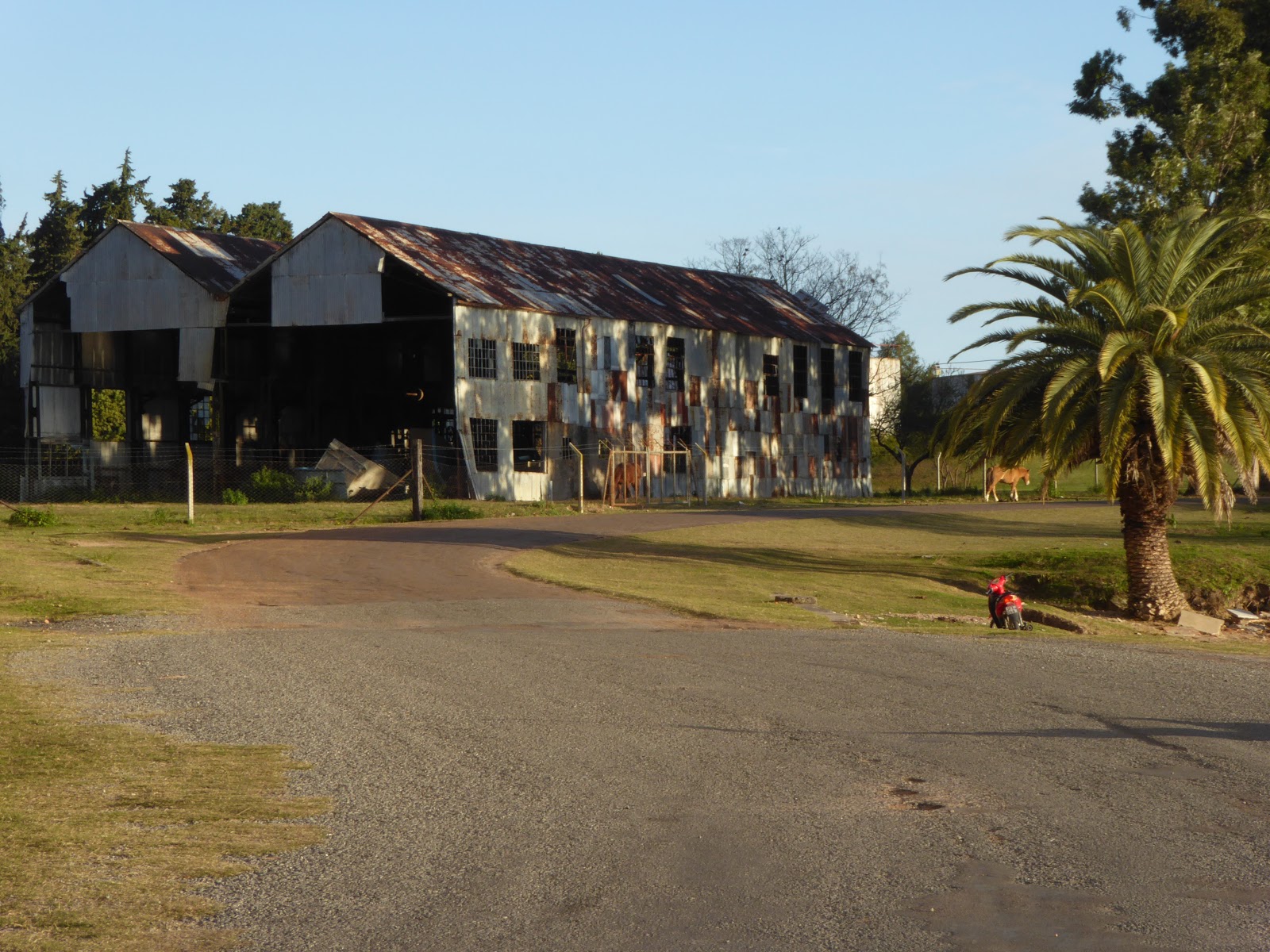
The following day, we duly got on the 1pm bus, which only took an hour or so, and finally made it into Uruguay! Fray Bentos, on first impressions, looked like any other nondescript Argentinian town - the only way you'd know you were in a new country were the Uruguayan flags flying. So why, might you ask, had we made all this effort to come to this town in particular? UNESCO, of course. Yep, Fray Bentos is home to one of Uruguay's two World Heritage sites.  You may have heard the name before - it's best known in the UK in relation to a line of meat products (Fray Bentos Steak and Kidney Pie, for example). The UNESCO status was awarded due to the remains of the famous meat factory that operated here during the 19th and 20th centuries, and all the cultural heritage that went with it.

Machinery in the old Fray Bentos factory
I have to say, I had not expected an old meat factory to be the most interesting place to visit, but I was proved completely wrong, and we were very glad we made the effort to come here. Since it was low season, we got a (free) private tour around the old industrial buildings, many still with rusting machinery etc. It was fascinating. We learnt that the company began in the 1860s, the project of a German chemist called Liebig. He had invented a way to 'condense' meat so that the nutrition provided from 33 cows could be concentrated into a single lump of a molasses-like essence, dissolvable in water to form a broth. It was basically the first ever stock cube! Liebig industrialised this process, building his factory in Fray Bentos and exporting his meat extract all over the world. It was particularly successful during war times. when soldiers relied on Liebig's Extract of Meat for nutrition. In the late 19th century the factory started making other meat products, including tinned corned beef, sold under the Fray Bentos label (still produced today). It also began a line called OXO cubes - sound familiar?

Dials on machinery - note that this was made in Bradford, England!
After WWI, the factory was bought by the English and renamed Anglo. It still produced the meat essence, but also diversified, with a huge refrigeration building being constructed capable of storing up to 1800 tons of meat. More than 60 different tinned products were sold under the Anglo label, including canned vegetables as well as meat in every form you can imagine. The factory went into decline during the 1960s and finally closed in the 1979, but the Fray Bentos brand lives on, now owned by the Scottish company Baxters. Our included visits to the machinery / engine room, the refrigeration building, the admin area, and even the slaughterhouse (not for the fainthearted... but also very impressive in its efficiency - they had invented the basis of a production line here before motor companies had laid claim to this idea!).  All of the buildings are extremely run-down and dilapidated, with falling down ceilings and asbestos covered pipes. They hope to restore things gradually, but our guide told us UNESCO status hasn't quite brought the millions they need for this yet. It's quite an experience as it is though - very ghostlike and a bit creepy a little like the ghost salt mining towns we went to in Chile.

More Fray Bentos factory buildings
From Fray Bentos, we discovered there isn't a great selection of buses to elsewhere in Uruguay. We had planned to go down to Colonia del Sacramento, but instead ended up opting to head straight to Montevideo, the capital, since there was nothing to Colonia until 7.45pm! There isn't a great deal to do in the capital, but it's a pleasant enough city. It was extremely cold when we were there - we were told unseasonably so, even for winter here. This must be true as we have found that in general Uruguay is not at all geared up for cold weather! Hardly anywhere has heating of any kind. Montevideo's 22km long Rambla (coastal promenade) must be pleasant in the summer but we were glad after a freezing 10km walk to get out of the wind and into a café.

Montevideo's seafront, which it has to be said isn't the most attractive!
We did manage to visit four museums in the capital. In the national museum, we learnt something of Uruguay's interesting history. During colonial times this area was originally part of a region called the Banda Oriental (the east bank of the River Uruguay). Both the Portuguese and the Spanish made claims to the region - the Portuguese founded the city of Colonia in 1680, and the Spanish then responded by founding Montevideo further south along the river in 1726. Later, ongoing Spanish pressure meant Colonia was eventually ceded to Spain in the 1770s. During the time of the wars of independence, Portugal once again invaded and occupied the Banda Oriental region several times, fearing that republicanism spreading here from Buenos Aires would stir similar sentiment in Brazil. Even after Brazil became independent from Portugal, Banda Oriental remained a part of the Empire of Brazil. It only became an independent state in 1828, after a war between Brazil and revolutionaries who wanted it to become part of the Rio de la Plata provinces (Argentina).  Brazil and Argentina finally agreed in an 1828 treaty to allow the region to be an independent territory, a sort of buffer zone between the two countries. Hence Uruguay was born.

Uruguay's national football stadium, in Montevideo
One of the other museums we went to was on football! This was attached to the Montevideo stadium, so we got to have a quick look inside, as well as seeing a ton of football trophies and memorabilia. Uruguay has quite a proud footballing history - it was the first country ever to win the World Cup (1930) and won it again in 1950; it also has won the Copa América more times than any other country (Argentina is only one behind on the latter count though, and the 2016 competition is currently taking place!).  We also visited the gaucho museum - gauchos (cowboys) are a fundamental part of Uruguay's culture, as in Argentina. On our last night in Montevideo we treated ourselves to a posh meal out at a restaurant. The chef had trained in France and Asia, and so a lot of the food had some Asian styles and flavours. It was quite a revolution for our taste buds after the past few months!

The 1930 World Cup trophy, in the football museum in Montevideo
We have now left Montevideo and arrived at last in the aforementioned Colonia del Sacramento, Uruguay's other UNESCO site. More on that (and Uruguayan wine tasting!) in our next blog.

Thursday, 5 May 2016

Mountains Through a Kaleidoscope

Exploring the northwest of Argentina feels a lot different to the rest of the country. It has a much larger indigenous population, and the sounds, tastes and buildings could belong to any of the other nearby countries - the north of Chile, or the south of Perú or Bolivia. The main cities are Salta and San Salvador de Jujuy (or just Jujuy), but there is a string of small towns following the long Quebrada de Humahuaca ravine north towards the Chilean and Bolivian borders.

The Quebrada de Humahuaca, from Tilcara
We arrived in Salta from Corrientes with the intention of hiring a car to explore the region before heading south. Originally, our plan was to drive all the way 1000+km south to Mendoza, but the fee for leaving the car there made it prohibitively expensive. Also, I didn't fancy driving the whole way - Jo wasn't able to take the wheel as her licence was stolen in Perú. Instead, we decided to just take the car around the surrounding area and leave it in Cafayate, just 200km away.

The road up to the Hornical
Salta had the feel of a lot of the other Andean cities that we've liked along the way, like Arequipa in Perú or Sucre in Bolivia. It even has a cable car to the top of the nearby hill, which seems to be a trend in many South American cities (La Paz, Quito, Medellín, Rio de Janeiro, etc). Our highlight, though, was the High Mountain Archaeological Museum (or MAAM - the Spanish acronym). It contains the remains of two children sacrificed by the Inca to their mountain gods. They were buried at the top of the region's highest mountain, at 6739m, and their bodies and the intricate grave goods have been perfectly preserved in the freezing temperatures.

Salta's take on the ubiquitous cable car
We left Salta in our hire car, driving north along the Quebrada de Humahuaca on the RN9. We soon found that, although the main road was in good condition, almost anything off the side of it was less so. Trying to get to the Lagunas de Yala, we had to turn round along one dirt road as it had been completely covered by a landslide. We did make it there a different way, making slow progress along another dirt road as we tried to protect our car from any flying pebbles. It was worth it for the great views along the valley from the winding mountain roads, even if the lagunas weren't that spectacular.

Not this way, then
The real reason for visiting this area is to see the celebrated coloured mountains. The most famous of these is the Hill of the Seven Colours rising above the small town of Purmamarca. The hill certainly lives up to its name! As this is probably the most accessible of the coloured mountains, it is also the most visited. Many of the towns in this area have been overrun by stalls of llama wool knitted into every form imaginable. This didn't prevent us from enjoying the spectacular hill and the drive past the town (and more coloured valley walls) up to the Argentinian salt flats, the Salinas Grandes.

Only Seven colours?
The salt flats, although not as big or as well known as those at Uyuni in Bolivia, are still an impressive sight. They stretch miles into the distance, with no point of reference until the mountains on the horizon. This was where we first discovered that cars don't run so well at 4000m above sea level, needing a lot more effort to get up the hills! 

Walking across the Salina Grande
The next time we went this high was to yet another coloured mountain, called the Hornocal, following a tip from an English couple to whom we got chatting in a restaurant in Tilcara. After a long hour drive along another gravel track outside of the town of Humahuaca, the view suddenly appeared before us of one of the most jaw-dropping sights of our trip so far. The entire opposite side of the valley was like a giant kaleidoscope. The Hornocal is also called the Hill of the Fourteen Colours, rather trumping the Seven in Purmamarca! It was relatively quiet and doesn't appear in so many guidebooks as the other hill, maybe because of the more difficult location.

The Hornocal
We had based ourselves in the small town of Tilcara, which is perfectly positioned to drive to many of the sights in the region. It is also home to a Pucará - a pre-Inca fort - looking over the Quebrada. Unfortunately, it was misguidedly reconstructed in the 1950s and isn't viewed as particularly authentic. However, because of its strategic position, it does have fantastic views over the entire valley. The whole Quebrada de Humahuaca has been listed by UNESCO, not so much for its natural beauty, but because of its archaeological sites. It has been in continuous use for over 10,000 years as an important route down from the Andean highlands to the lowlands of the south of the continent.

The reconstructed Pucará de Tilcara
After finishing driving around the dry, desert-like Quebrada, we are now moving across to the more humid, jungle-like Calilegua National Park. We will then be heading south towards the wine growing regions of Cafayate and Mendoza.

A closer view of the Hornical

Sunday, 1 May 2016

Why Does Nobody Go To Paraguay?

Paraguay is not somewhere you hear much about when travelling South America. Most people seem to skip it all together, or perhaps just go across for the day from Argentina or Brazil for a cursory country grab. Neither Lonely Planet or Rough Guide even bother to produce a guide for Paraguay - it gets a short mention in the Lonely Planet Shoestring guide that covers the whole continent, but that's it. So unlike most places we've been, we really didn't know anything about this country before we arrived, or have any idea what to expect of it.

Sunset in Encarnación
Paraguay is a landlocked country, bordering Bolivia, Brazil and Argentina. It is home to an amazing variety of different environments and habitats, including the Chaco, the Pantanal, and Atlantic rainforest. A lot of the country is still relatively untouched wilderness, and there are many conservation projects trying to limit deforestation and protect its rich biodiversity.

Street in Asunción
We had hoped to do more than the average tourist in Paraguay and get off the beaten track a little: we'd read that this is difficult to do, but dismissed this as hyperbole. However, once in the country we found that the reports were more accurate than we'd imagined! Paraguay really isn't particularly bothered about attracting tourists so there is very little tourist infrastructure and it is hard to find accurate information about anything other than the urban centres.

The Chaco region, a semi-arid area rich in wildlife, makes up more than 60% of Paraguay's land area, but less than 2% of the country's population lives there. We had wanted to explore this region, but as it so sparsely populated it is somewhat challenging to get around. The Pantanal, a wetland region on the border with Brazil, is also something of a mission to get to. We met an Australian at our hostel in Asuncion who was trying to go there - his journey would involve a 7 hour bus, a public boat for 3 days, and then having to hire another boat himself for the final section. Maybe earlier in our trip we'd have been up for this, but this late on we are trying to push on to see as much of the rest of the continent as we can in our last few weeks.

Lake view from Aregua, near Asunción
What we did think would be feasible was visiting one of the country's protected areas of Atlantic forest, the San Rafael National Park and Reserve. This is only a 3 or 4 hour journey from Encarnación, and we had already managed to get in touch with staff at the park and provisionally booked a cabin for a few days. However, when it came to our planned day of departure, circumstances conspired against us. The night before, the horrendously hot and humid weather (39 degrees!) finally broke - there was a big thunderstorm and it rained all night and was still pouring the next morning. The road to San Rafael is unpaved and often becomes impassable in bad weather. We managed to phone the park from our hostel, and were told it would be impossible to go that day. We stayed another night in Encarnación and hoped that the weather would brighten up enough to dry the road by tomorrow. Alas, the downpour continued all day, and park staff told us the next day that the road was still impassable. We really wanted to go, but the forecast wasn't good for the rest of the week either, so we reluctantly gave it up as a bad job and got on a bus to Asunción.

Ceramics for sale in Aregua, near Asunción
About an hour into the journey to Asunción, we went through the small town of Coronel Bogado. We remembered the name from something the friendly old lady at our hostel in Encarnación had said to us - that the best 'chipas' in the country are made there. Chipas are dense, baked rolls made from maize and flavoured with Paraguayan cheese. They are quite an institution in Paraguay and the neighbouring area of Argentina - street vendors carry baskets of them in all sorts of shapes and sizes. When the bus stopped in Coronel Bogado, a couple of sellers got on, and we knew this must indeed be the famous place as literally all the locals on the bus bought some! Obviously we did too, and they were the best we had anywhere. Yum. Another interesting part of Paraguayan culture is the tereré - like Argentinian maté tea, but served cold. Most locals constantly carry around large water flasks in special carry cases with a pocket for their tereré cup!

Palacio de Gobierno, Asunción
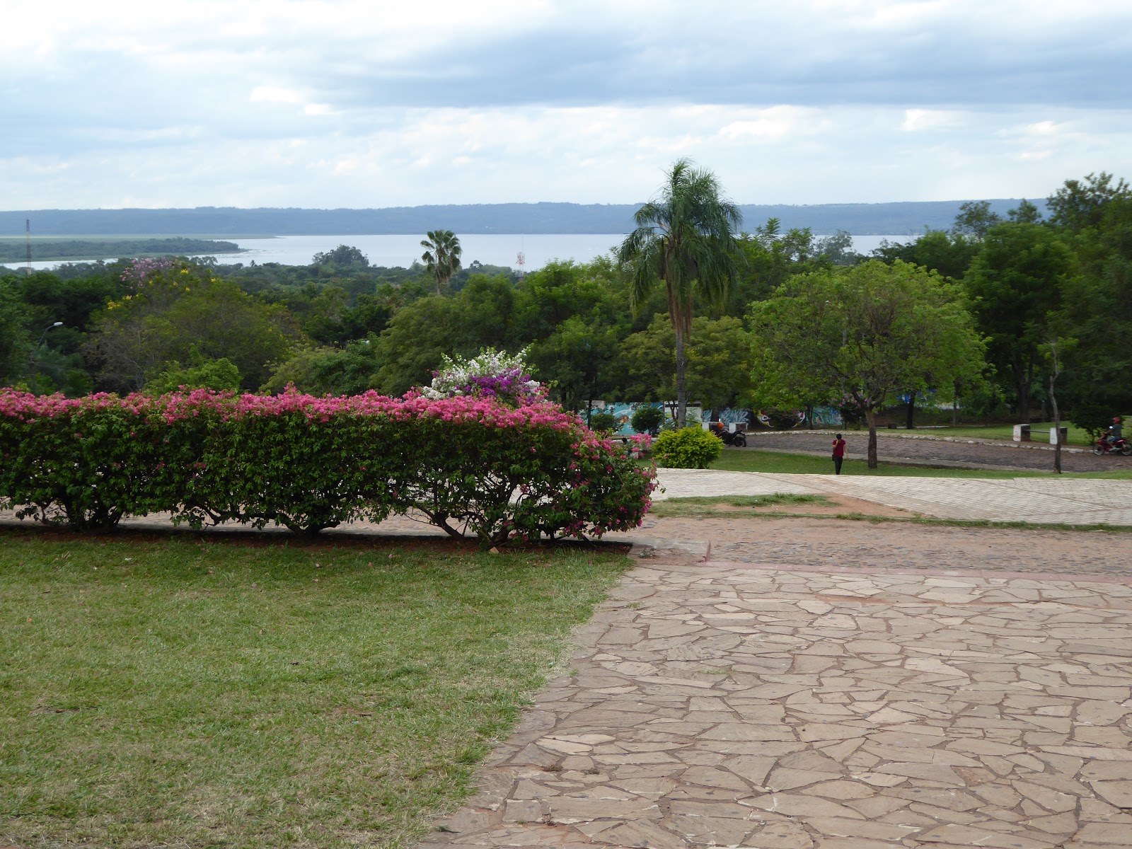
Despite being the Paraguayan capital, Asunción doesn't have a lot to see or do. We dutifully spent an afternoon wandering around the centre, but weren't very taken with any of the sites other than the Palacio de Gobierno, an impressive, large colonial building painted pale pink. We thought this was a lot prettier than the famous Casa Rosada in Buenos Aires! The city has bit of a feel of faded glory - there are quite a lot of old buildings but most are very dilapidated and little or no effort has been made to conserve them. Asunción is actually one of the oldest cities in South America, founded in 1537, and in colonial times it was also one of the most important. Since independence however, and after the Paraguayan war in the 1860s, the city lost its importance and the national economy has declined rapidly. The war, also known as the Triple Alliance war (Paraguay against the combined forces of Brazil, Argentina and Uruguay) had a massive impact on Paraguay. It was one of the worst military defeats ever inflicted on a nation - more than 60% of the population died, and 90% of the country's men. Really, Paraguay is still struggling to recover from the effects of the war today.

Modern and old combined, in a courtyard in Asunción
Asunción is built on the Paraguay river, and  few months ago it was hit by some of the worst floods in decades, which you might have seen on the international news. Tens of thousands of people were displaced from their homes, and sadly it seems many of them still have nowhere to live. We walked past a huge, makeshift camp or shanty town, with hundreds of people living in wooden shacks or just tents made from bin bags with no sides. The camp was in one of the city's biggest plazas, right on the doorstep of the presidential buildings - maybe to make a point, as the government is apparently doing little to help. It was sad and quite shocking to see.

Riverfront and very cool sky in Corrientes
We met no other tourists in Encarnación, so were surprised to find a really excellent, sociable hostel in Asunción (El Nomada). We spent a lot of time just hanging out there and chatting. Most people travelling Paraguay are not your ordinary tourist, and we met some great people, including a couple of bikers who'd been travelling the world with their huge bike and sidecar for three years! We also went with another English guy we met to a nearby town, Areguá, which is famous for its ceramics. We reluctantly left this fantastic hostel after 3 nights and embarked on another long bus ride (8 hours) back over the border to Argentina and the cities of Corrientes and Resistencia. The weather had been fine for the previous two days, but a little like our last night in Encarnación, there was a big storm the night before we left Asunción. The temperature dropped literally 20 degrees in a day. After being at temperatures well above 30 degrees for several weeks, 10 degrees was quite a shock! We had to dig out our coats and jumpers again that we'd thought we'd not need for the rest of the trip.

Monastery in Corrientes
For the next couple of days, we stayed in the Argentinian city of Corrientes, the capital of the Corrientes province. It is only a 20 minute drive away from the neighbouring city of Resistencia, across a river which marks the border between provinces. So, strangely, Resistencia is also the capital of a province - the Chaco province! We liked both of these cities as they were just typical Argentinian cities, with no tourists. The locals were super friendly and whenever we sat down in a cafe we'd get engaged in conversation by people curious to see us there! Corrientes is the more historic of the two, while Resistencia is known as Argentina's 'Capital of Sculptures'. Every 2 years the city has a competition that sculptors come from all over the world to take part in - they have 7 days to produce a sculpture. The best ones are displayed either in the museum or on the streets - more than 200 line the streets in the centre already.

Sculptures in Resistencia
From Corrientes we took our first night bus since Colombia - 13 hours up to Salta in the north of Argentina. We had forgotten how expensive buses are in Argentina - £45 a person! We are looking forward to exploring more of this area now, and probably hiring a car.

Tuesday, 15 March 2016

Curaçao Drinking in Curaçao

In order to skip the dangerous Venezuela, we found the cheapest flight to Guyana would go via the Dutch island of Curaçao. We decided to spend a few days there to do a few dives and drink the famous liqueur. We also discovered that the main town, Willemstad, is a UNESCO world heritage site!

We didn't get any diving photos, so here's one of a beach instead
The dives here were great - we were collected by the guys that run Scubaçao (unfortunately not pronounced Scuba-Cow) and driven around to the dive sites. It made a nice change to be able to just walk off the beach and dive straight away without having to take a boat. The visibility was amazing, around 30m, and there was plenty of healthy coral, lots of different fish and even some turtles. The best site was probably the one called 'Tugboat' - named after a tug that sunk there when a ship dropped an anchor on it. It is now home to several schools of fish and was fascinating to swim around.

The colourful waterfront in Willemstad
When we weren't diving, we walked around the old city, which was founded in 1634. It spent much of its life as a slave trading port, and there are a couple of good museums dedicated to that awful subject today. The slave trade, the proximity to Spanish-speaking Venezuela, its status as part of the Netherlands and today's tourism has led to an interesting mix of cultures. The local language, Papiamentu, is a combination of Portuguese, Spanish, Dutch and English and we found it strange to be able to pick up words of it here and there.

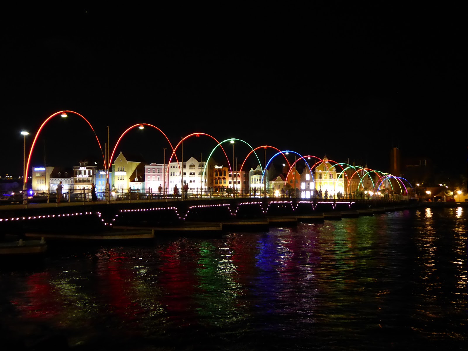
The Queen Emma floating bridge across Willemstad harbour
Willemstad is now home to a unique floating bridge across the harbour entrance, which swings open when a ship needs to pass. Often, those ships are cruise ships, and the island is full of people supping cocktails made from the local blue curaçao liqueur. From our experience, it's used to make rather sickly blue-green cocktails that pack quite a punch.

Cocktails!
We're now recovering from our hangovers and flying back to the mainland, to Guyana.

Saturday, 12 March 2016

Golden Showers - Well, Gold and Showers

We had enjoyed our time in San Agustín and Tierradentro as they're a little further off the gringo trail (especially Tierradentro). However, now it was time to head firmly back into tourist central - Bogotá, Colombia's capital. We took a nightbus from San Agustín that arrived at 5am, and spent a lot of time drinking coffee until we could check in to our AirBnB later on. We'd chosen to base ourselves in the historical district, La Candelaria, which is where most of the attractions are, and the AirBnB was great - run by a very friendly French-Colombian family.

The main square, Plaza de Bolívar, in Bogotá
So, Bogotá. Bogotá is big.Very big. In terms of population, it is the fourth largest city in all of South America and the second largest we've been to behind Buenos Aires, with nearly 10 million people. It is also high, at about 2650m - the third highest capital city in the world after La Paz and Quito. And based on our experience, Bogotá is also rainy. It rained every day while were here, including some enormous thunderstorms that flooded some streets and caused delays at the airport when the control tower was struck by lightning! The weather liked to fool us by appearing beautifully sunny every morning. Thus without fail we'd say, 'shall we take the raincoats? Nah, we won't need them.' And without fail we'd get soaked. Apparently this much rain is unusual for the time of year, and probably due to the El Niño phenomenon.

Incredibly detailed figures in the Gold Museum
There's plenty to do in Bogotá, and we duly visited the majority of its major tourist sites. One of the highlights was the Museo de Oro (Gold Museum), which is one of the best museums we've been to in South America so far. It tells the history of gold in Colombia, focusing on pre-Columbian times and explaining how gold was obtained, what was made with it, the indigenous mythologies surrounding it, and so on. There were plenty of stunning gold items on display, some dating from over 2000 years ago yet incredibly complex, intricate and beautiful in their designs.

Street art on the graffiti tour
Aside from the Gold Museum, we spent one morning doing the popular graffiti tour around La Candelaria and the city centre. This was quite interesting but the group was huge - over 30 people! - and the guide focused more on the artists' styles than on the actual content / meaning behind the street art. We'd have liked to know WHY a given artist had chosen to portray a toucan with a halo, rather than how he'd done it! We also took the cable car (so many cities in South America have cable cars!) to the top of Cerro Monserrate, up at 3100m. The view of the city was quite nice, but sadly the clouds rolled in, the vista deteriorated extremely quickly and the torrential rain began anew. Another day we visited the Police Museum, which included quite a lot of interesting information on the hunt for Pablo Escobar in the early 1990s. On display there was even a desk Escobar owned, which on first sight looks normal, but when kicked in a certain way reveals a false back and false bottom, with several secret compartments. There was also a sophisticated machine Escobar had used for counting banknotes; the only other one of these in the country at the time was in the national bank!

Somewhat hazy view of Bogotá from Cerro Monserrate Wanted poster for Pablo Escobar, in the Police Museum
We had heard a lot about the Salt Cathedral in the town of Zipaquirá, which is often described as 'the marvel of Colombia'. Understandably, we were keen to visit, and as Zipaquirá is not far from Bogotá, we made a day trip. It took us an hour and a half from La Candelaria using the Transmilenio bus-metro thing (more on that to follow!) and then a local bus. On arrival, we were horrified to find the ticket price for extranjeros (foreigners) was 50,000 pesos. That is, £10. Which is a LOT in Colombia! For reference, the Gold Museum cost 3,000. Even for Colombians the price was 28,000, which would definitely price a lot of locals out of coming here. Pretty ridiculous. Still, we thought, we're here now, and we reluctantly paid up.

The main nave in the Salt Cathedral
The Salt Cathedral is basically a huge church built underground in a salt mine, complete with the stations of the cross, also made of salt, on the way. I have to say that the cathedral itself was pretty cool - it was incredible to be in this huge chamber with high ceilings and massive pillars, all deep underground and mostly built of salt, granite and marble. The stations of the cross were also well done, we thought - mostly very understated and simple. However, what we didn't like was the way the entire experience had been made into a massive tourist trap. You had to go round with a guide (totally unnecessary), there was cheesy music playing, and at the end we were greeted with rows of the usual artesania shops. Yes, souvenir shops. And a coffee shop. Down a salt mine! On top of this, anything extra had to be paid for on top of the crazy first price; extra if you wanted to go in the museum, extra to see more of the mine, extra even for toilet paper...! We were very disappointed overall as we felt the whole place was a bit of a farce and a complete rip off. But ho hum, we had to see it really.

One of the Stations of the Cross
Our spirits that day weren't improved by the arduous journey back to Bogotá from Zipaquira. This was our first experience of the Bogotá traffic, which is quite legendary. You'd think in the late afternoon the traffic would be okay coming back into the city, just bad leaving it. You'd think wrong. It took us 3.5 hours to get back. As I mentioned before, part of the journey involved the Transmilenio, which is Bogotá's equivalent of a metro. But rather than a train, it is a bendy bus, 2 or 3 carriages long. Many things about this bus challenged our brains. For example, why have an 'express' bus when it can only go at the same speed as the non-express buses? They all go in the same lane and can't overtake. Or, why not let all the people leaving the bus at the stop get off before everyone else shoves their way on? And, why plan your rush hour schedule so that 90% of the buses coming through the busiest platform at 6.30 pm are 'en transito' (in transit) and not stopping?! Maybe we were just in a bad mood, but we were tearing our hair out a little! Oh for the good old Tube.

View of Bogotá from our AirBnB
On our last day in the city, we decided to treat ourselves to a posh restaurant as a belated celebration of our being away for one year. Said restaurant, Matiz, was 8 or 9 km from where we were staying. Given our experience of the traffic, we left nearly an hour to get there (by taxi). It took us an hour and a half. The taxi driver seemed determined to use the big main road, despite it being completely rammed with traffic. At one point he turned off, and we breathed a sigh of relief, thinking he'd finally seen sense and was going to go via the nearly empty side roads instead. But no, after a few blocks it became clear he was instead just heading across to the other big main road. Which, surprise surprise, was almost stationary. Dare we suggest that if more drivers were willing to use non main roads, the traffic problem might be slightly less bad?!

More street art around La Candelaria
Anyway, end of traffic related ranting! Luckily the restaurant had kept our table and we enjoyed a fantastic meal - a tasting menu of I don't know how many courses that has to be one of the best meals of the trip so far. Cocktails and then wine pairings with each course meant we soon forgot our frustration with the journey. It was a nice way to say goodbye to Colombia, and to Latin America for a while as we move on to destinations more Caribbean in their nature. Next, the island of Curaçao, before we head to the Guyanas.

Wednesday, 10 February 2016

San Andrés Island - Colombian by Name not by Nature

We had always wanted to go to a Caribbean island as part of this trip, but were horrified by the price of the flights to most of the islands from Colombia. However, on reading about the little island archipelago of San Andrés, we realised we might be able to manage our Caribbean island after all.

The San Andrés group is made up of three islands - San Andrés, Providencia, and Santa Catalina. While located in the Caribbean some 700km from Colombia and closest to Nicaragua, the archipelago is actually officially part of Colombia. Flights here from inside Colombia are thus domestic flights, and far cheaper than to anywhere else we'd looked at in the Caribbean. After learning that the islands are also renowned for their diving and snorkelling, we decided to fly out from Cartagena and spend a few days there.

San Andrés island
We booked these flights a couple of weeks in advance and although we'd heard the best things about Providencia, we chose to visit only San Andrés, the largest of the three islands. This might sound counter-intuitive, but we had done some research into dive centres and discovered a couple of highly rated ones in San Andrés, while those in Providencia sounded less promising / safe. San Andrés island itself we had heard was far from paradisical, but as we were going mainly for the diving we thought this would be fine. We also didn't much fancy the 4 hour choppy catamaran ride over to Providencia!

Our flight was full of holidaymakers, mostly Colombian but a lot from the rest of South America too. Especially Brazil, for some reason. San Andrés is a tiny island, only about 10km long, and as our taxi drove us through the main town after landing we noticed that it was indeed pretty ugly. A rapid boom in tourism had indelibly marked the place. Concrete 1960s style buildings everywhere; big hotels, casinos, and souvenir and duty free shops lined the streets. We stayed at a nice place just out of town, about a half hour walk from the centre and away from all the noise.

Holidaymakers on one of the least busy San Andrés beaches
San Andrés and its two sister islands are part of a huge marine protected area of 180,000 km² called the Seaflower Biosphere Reserve. It is recognised by UNESCO as one of its World Network of Bioreserves and is home to one of the largest coral reefs in the world. So a great place to get some more diving experience! We booked through a dive centre called Karibik, run by a friendly German instructor called Christian. For our first three days on San Andrés, we dived twice each day, visiting several different dive sites. It was a new thing for me to just do some fun dives rather than a course, and I have to say, I panicked a little when I first got into the water again - all the equipment felt completely different and unnatural - but once I got underwater it was fine. Christian was a great instructor to dive with - he always let the group dive for as long as possible and shared his air with whoever got low first to allow the rest of the group to continue longer. Most of the dives were 55 - 60 mins, a lot longer than the dives I did in Taganga.

The diving was pretty nice: highlights included the 'Blue Wall' site, where we saw several reef sharks, and a site on the first day where we saw the biggest eel I have ever seen! Sadly we didn't have an underwater camera to capture this, but the monster's head was at least a foot across. It was like some huge underwater serpent in a Disney movie! I had no idea Moray eels could get so enormous. We also enjoyed the coral, which was varied, quite colourful and seemed in good condition. One of the dive sites had what was like a forest of coral, with structures that looked similar to ferns and huge leaves. Really pretty. Plenty of fish too, though fewer and less varied than we had anticipated to be honest. Unfortunately, this is probably a result of overfishing around here.

Palm trees lining the coast road. Note the gorgeous colour of the Caribbean Sea
 in all of these photos!
On our third day of diving, rather than returning to the dive shop in town between dives as we had been doing for the other two days, we spent our break at El Acuario, a small cay that is one of the most popular spots for mainstream tourists here. This gave us our first glimpse of how most tourists spend their time here. The tiny island was absolutely crowded with people, both in the sea, lying on the beaches and spilling out of the one café. It's called 'El Acuario' (the aquarium) because some marine life can be seen while snorkelling there, particularly stingrays. However, the way the stingrays were treated was horrendous! A stingray would be attracted there by feeding it, and then would be captured and held still while tourist after tourist took turns to have their photo taken holding it. So completely opposed to anything we've ever been taught about how to treat marine life (NEVER touch anything). It was quite shocking. Sadly, all the tourist agencies here advertise the stingray tours as an 'amazing, once-in-a-lifetime experience'. There are similar manta tours. We couldn't quite believe these activities were permitted at all, let alone promoted.

On our last day, we didn't do any diving and moved to stay for one night in the south of the island. This was a whole different world from the unpleasant main town - older, more traditional island architecture, cleaner, quieter beaches and a higher proportion of native (i.e. not Colombian) people living there. We had a nice walk around the south coast, happy to be away from most of the tourists. That evening we had dinner in town, and then got a taxi for the 8km or so back to our accommodation in the south. This turned out to be one of the best things we did. The taxi driver was a native islander, speaking Creole English, and it was fascinating, if sobering, hearing his story and the history of the island and its original inhabitants.

One of the quieter, beautiful southern beaches of the island
The San Andrés archipelago was first settled in the 17th century by English Puritans, and later pirates (again English). The English also brought in African slaves. While it later became a possession of the Spanish Crown and then in 1822 officially part of Colombia, no Spanish settlers ever came there and it retained its English-Caribbean flavour. The Colombian government also initially made no attempt to make anything of their island territory, and the islanders were left alone for years. Things only changed when in 1912 Colombia adopted a new policy of 'Colombianisation', enforcing Spanish language, religion and culture on the native San Andrés people.

An even bigger change came when in 1953 the Colombian government declared San Andrés a free port. This led to a huge influx of Colombians looking for a new life in paradise, and a massive construction boom in the 1960s. To give some idea of the magnitude of the change, in 1952 San Andrés had around 6000 inhabitants. In 1973 it was 23,000. Today, it's 80 or 90,000, and the population is still growing rapidly. Land that used to be agricultural has been replaced by housing, lagoons have been filled in and replaced by the port and airport, self-sufficiency has gone in favour of imports from the mainland, and there is a huge problem with rubbish and pollution of the water supply.
Don't think this boat will be going anywhere fast! Horses and an old boat, near
one of the native islanders' houses in the south 
The two taxi drivers we spoke to over the next two days both told us that they did not feel in the slightest bit Colombian. Most natives are descendants of the original English settlers and African slaves. They have names like Williams, Robinson, McDonald or Smith, speak Creole English and are devout Protestants. They resent the way that Colombians are coming in, treating the land how they feel, enforcing their own culture and traditions and not respecting those of the local people. One man we spoke to, a Mr Williams, even asked us to please go and speak to our English government and ask them to come and take back their rightful territory! The other taxi driver told us, with real sincerity, that 'God sent the Colombians to San Andrés to punish us for our sins.' Native people feel the Colombian government simply does not care about San Andrés, other than the revenue it brings in from tourism.

To summarise, we had a great time diving round San Andrés, but as part of our visit, we became more aware of the controversial and sad history of the island and the challenges its people are facing.
Unless things change, it doesn't look like the remaining beauty of San Andrés, its outstanding marine environment and unique island culture will be preserved much longer.