Showing posts with label lakes. Show all posts

Thursday, 5 May 2016

Mountains Through a Kaleidoscope

Exploring the northwest of Argentina feels a lot different to the rest of the country. It has a much larger indigenous population, and the sounds, tastes and buildings could belong to any of the other nearby countries - the north of Chile, or the south of Perú or Bolivia. The main cities are Salta and San Salvador de Jujuy (or just Jujuy), but there is a string of small towns following the long Quebrada de Humahuaca ravine north towards the Chilean and Bolivian borders.

The Quebrada de Humahuaca, from Tilcara
We arrived in Salta from Corrientes with the intention of hiring a car to explore the region before heading south. Originally, our plan was to drive all the way 1000+km south to Mendoza, but the fee for leaving the car there made it prohibitively expensive. Also, I didn't fancy driving the whole way - Jo wasn't able to take the wheel as her licence was stolen in Perú. Instead, we decided to just take the car around the surrounding area and leave it in Cafayate, just 200km away.

The road up to the Hornical
Salta had the feel of a lot of the other Andean cities that we've liked along the way, like Arequipa in Perú or Sucre in Bolivia. It even has a cable car to the top of the nearby hill, which seems to be a trend in many South American cities (La Paz, Quito, Medellín, Rio de Janeiro, etc). Our highlight, though, was the High Mountain Archaeological Museum (or MAAM - the Spanish acronym). It contains the remains of two children sacrificed by the Inca to their mountain gods. They were buried at the top of the region's highest mountain, at 6739m, and their bodies and the intricate grave goods have been perfectly preserved in the freezing temperatures.

Salta's take on the ubiquitous cable car
We left Salta in our hire car, driving north along the Quebrada de Humahuaca on the RN9. We soon found that, although the main road was in good condition, almost anything off the side of it was less so. Trying to get to the Lagunas de Yala, we had to turn round along one dirt road as it had been completely covered by a landslide. We did make it there a different way, making slow progress along another dirt road as we tried to protect our car from any flying pebbles. It was worth it for the great views along the valley from the winding mountain roads, even if the lagunas weren't that spectacular.

Not this way, then
The real reason for visiting this area is to see the celebrated coloured mountains. The most famous of these is the Hill of the Seven Colours rising above the small town of Purmamarca. The hill certainly lives up to its name! As this is probably the most accessible of the coloured mountains, it is also the most visited. Many of the towns in this area have been overrun by stalls of llama wool knitted into every form imaginable. This didn't prevent us from enjoying the spectacular hill and the drive past the town (and more coloured valley walls) up to the Argentinian salt flats, the Salinas Grandes.

Only Seven colours?
The salt flats, although not as big or as well known as those at Uyuni in Bolivia, are still an impressive sight. They stretch miles into the distance, with no point of reference until the mountains on the horizon. This was where we first discovered that cars don't run so well at 4000m above sea level, needing a lot more effort to get up the hills! 

Walking across the Salina Grande
The next time we went this high was to yet another coloured mountain, called the Hornocal, following a tip from an English couple to whom we got chatting in a restaurant in Tilcara. After a long hour drive along another gravel track outside of the town of Humahuaca, the view suddenly appeared before us of one of the most jaw-dropping sights of our trip so far. The entire opposite side of the valley was like a giant kaleidoscope. The Hornocal is also called the Hill of the Fourteen Colours, rather trumping the Seven in Purmamarca! It was relatively quiet and doesn't appear in so many guidebooks as the other hill, maybe because of the more difficult location.

The Hornocal
We had based ourselves in the small town of Tilcara, which is perfectly positioned to drive to many of the sights in the region. It is also home to a Pucará - a pre-Inca fort - looking over the Quebrada. Unfortunately, it was misguidedly reconstructed in the 1950s and isn't viewed as particularly authentic. However, because of its strategic position, it does have fantastic views over the entire valley. The whole Quebrada de Humahuaca has been listed by UNESCO, not so much for its natural beauty, but because of its archaeological sites. It has been in continuous use for over 10,000 years as an important route down from the Andean highlands to the lowlands of the south of the continent.

The reconstructed Pucará de Tilcara
After finishing driving around the dry, desert-like Quebrada, we are now moving across to the more humid, jungle-like Calilegua National Park. We will then be heading south towards the wine growing regions of Cafayate and Mendoza.

A closer view of the Hornical

Friday, 19 February 2016

Visiting the (1990s') Most Dangerous City in the World

Medellín still has a fairly bad reputation internationally, having been the most dangerous city in the world during the 1990s. It was home to the infamous Medellín Cartel, headed by Pablo Escobar. Daily life was plagued by violence, drugs, shootings and bombs. Since then, though, the city has cleaned up its act and in 2013 was even named as the 'most innovative city in the world'. Walking around the central neighbourhoods of El Poblado and Laureles today feels safer than many other cities that we've visited.

Past and future:
A bird sculpture by Fernando Botero, Medellín's
and Colombia's most famous artist, was badly damaged by a bomb, so
the artist made a new one to go alongside it as a symbol of regeneration
The city, a bit higher than we've been recently at an altitude of around 1500m, spreads along a valley floor and up its sides. It is connected by an excellent metro network of trains and cable cars linking the areas further up the valley slopes. One of these cable cars takes you to Arví Park, where we enjoyed strolling through tree lined paths and an artisan's market serving craft beer while taking in spectacular views over the city. On the way back, our train was delayed by an hour with no explanation - it seems that some things aren't too different from home!

Medellín from near Parque Arví
One morning, we set off to the Minorista market to join a tour of exotic fruits. Our guide explained that, a few years ago, this market used to be a pretty sketchy place. It has now changed dramatically and is completely safe - tourism is a way to help the locals  and improve its image. We were each handed a spoon and taken around various stalls trying out different obscure fruits. Our favourites, mangosteen and dragonfruit, recalled our travels in Asia.

Trying guava in Minorista market
A couple of hours outside of Medellín, near the town of Guatapé, is a reservoir towered over by the impressive Piedra del Peñol - a giant granite monolith. We walked up the 740 steps to the top for some magnificent views of the surroundings. Guatapé itself is a really pretty town - almost all of the buildings are brightly coloured and decorated around the base of their walls with tiles showing images of the Piedra, geometric designs and products on sale amongst other things.

The Piedra del Peñol Colourful houses in Guatapé
The Guatapé reservoir from the top of the Piedra del Peñol
From Guatapé, we were heading to Honda but wanted to stop at Río Claro (Clear River) natural reserve on the way. This made the journey a bit of an effort. We took a bus out of Guatapé down to the main road, then hailed down a second bus to the reserve. When we left, we took a third bus along the road to Dorradal, where we were lucky to find a direct bus to the final destination of Honda. Río Claro proved a worthwhile diversion - we spent a couple of hours walking alongside the river lined with cliffs and jungle. The valley is made out of marble, which made interesting rock formations along the river banks and there was plenty of wildlife around. Lots of butterflies (Jo's favourite), a jumping stick insect, a troop of monkeys and, our highlight, a coati climbing a tree.

Río Claro
We've booked flights out of Colombia in March, so don't feel like we have that much time left here now. This meant that we had to leave both Medellín and Guatapé a bit earlier than we'd have liked to. Next, we're now moving on towards the coffee growing region of Colombia.

Wednesday, 23 December 2015

Canyoning and Cliff Top Swings

Bus journeys in Ecuador are generally nice and short; we only had a 2 hour ride from Riobamba to our next destination - Baños. This is a small town at 1800m, not far from the beginning of the jungle in the east, and a favourite with backpackers. It's known for two things in particular - the thermal baths that are its namesake, and adventure activities.

The river in Baños, with waterfalls coming down into it 
We had three days here and managed to fill them with lots of fun stuff. On day one, we hiked for 3 hours or so up to the top of one of the nearby hills to visit the Casa del Arbol (tree house) at the top. En route we saw a sign for the 'Vuelo del Condor' (Flight of the Condor) with pictures of a huge swing. It was only a short detour so we decided to give it a go. Good choice - it was awesome! It is a basically a gigantic swing off the edge of a cliff, run by a couple of locals out of their back garden. One at a time, we were harnessed in and tied to the swing seat then pushed off the cliff! The free fall down to the bottom of the swing to start with was very scary (I may have screamed a LOT) but an incredible adrenaline rush. And then you were swinging high in the air, with eagles soaring nearby and amazing views down. Worth the $5 I think.

Kev on the Vuelo del Condor swing
Our eventual destination, the Casa del Arbol, turned out to be a bit lame. It's not just a treehouse but a little park with a cafe, a very tiny zipline and the famous End of the World swings. Unlike the Condor swing, where we were the only people there, this place was full of backpackers, and we had to queue for 10 minutes to have a quick go on the (crap) swings, which were much like ordinary playground ones! The best thing about here was the view, which was pretty spectacular. But the Condor swing was the highlight of the day - very glad we went there.

The Casa del Arbol, and me on the End of the World swing
On our second day, we signed up for a canyoning trip at the nearby Rio Blanco. Neither of us had tried this activity before, but it looked really fun and Baños was a good place to give it a go. For those of you who don't know, canyoning is essentially rappelling down waterfalls. Though, as we learnt, it is not just that but includes all sorts of other methods of getting down waterfalls - jumping, sliding on your bum, ziplining... We were both pretty nervous at the start, as we stood at the top of a huge waterfall and were encouraged by our guides to lean backwards and begin abseiling down it! We soon got the hang of it though, and particularly enjoyed the final waterfall where we sat at the top and basically slid down, while roped in. We felt very safe the whole time and had so much fun. I'd like to do it again!

Canyoning at the Rio Blanco
Our hostel here didn't include breakfast, and one morning we came across a nice looking cafe and decided to try it. The Danish lady owner seemed a bit odd. As we went in, she said 'Oh, you want breakfast too do you? That's the last breakfast I'm doing today!'. We were slightly taken aback but smiled politely and sat down. When we saw the menu we did a double take though - erm, $8 each for a breakfast?! Too late to back out now though, we thought. The lady actually turned out to be quite insane. She took an hour to bring us our breakfasts, while she lectured us continually about how good her bread is, her fruit salad is, etc, and how she makes 50% profit on everything, unlike all the other cafes in town which only make 30% apparently (why do we need to know this?!).  She also had an obsession with the nearby Pailón del Diablo waterfall, pontificating at great length on how we HAD to go there. We were in the cafe for 2 hours in the end and thought we'd never escape!

With one of our canyoning guides at the bottom of a waterfall
However, the Danish lady did actually get something right. On day 3 we took a local bus out to the Pailón del Diablo (Devil's Cauldron) waterfall, about half an hour away from Baños. After a short hike through cloud forest, we arrived at the first viewpoint of the waterfall. I cannot even begin to describe how awesome (this word is used in the correct sense for once here, I think!) it was. One of those examples of raw nature so spectacularly beautiful it makes you quite emotional. We stood there for some minutes just gaping at it, speechless. The waterfall is huge - about 70m high, but what makes it so breathtaking is the sheer volume of water that is coming thundering down, literally right in front of you. Water reaching the bottom crashes and comes spewing back into the air, creating an amazing effect. You can see where its name comes from - the bottom is just a foaming cauldron of white water and water vapour, with jets spewing in all directions and spray everywhere. We got very wet! One of my favourite waterfalls ever.

The Pailon del Diablo waterfall

From Baños we headed up to the city of Latacunga at 2800m and had a night there before taking a bus the next day to Quilotoa. This is a small village right up in the sierra at 3800m, in beautiful scenery. Most people come to this area to hike round the scenic Quilotoa Loop -  3 or 4 days, hiking a circuit from village to village. We had not planned our time here too well though and only had 2 days before we had to head to Quito, where we have booked for Christmas. So we decided to confine our exploring to Quilotoa itself.

Laguna Quilotoa
The main attraction here is the huge volcanic crater lake, Laguna Quilotoa. We were blown away by this - it's stunning. On our first day in Quilotoa, we walked the 5 mins from our hostel to see the lake from a viewpoint above. After admiring it for a while, we spent the rest of the day resting as we needed a little time to readjust to the altitude here - it's been a while since we've been this high. The next day we hiked the trail around the top of the lake. We had imagined this would be a fairly easy stroll. Erm, no. It was 3.5 hours of constantly going up and down steep peaks, along paths that were often deep sand. And no switchbacks, just straight up, as seems to be the theme with most trails in Ecuador. The views were magnificent though, not only down into the emerald blue lake, but also the surrounding countryside with its patchwork of steep fields and terraces.

Beautiful scenery surrounding Quilotoa
We are now back in Latacunga and tomorrow will head to Quito, where we'll be for a few days over Christmas. MERRY CHRISTMAS one and all!

Wednesday, 16 December 2015

Buses to the Middle of Nowhere

'Here?' asked the bemused bus driver when we asked him to stop. We were two hours outside of Riobamba, itself not the most touristy of towns, and another three hours to the next town of note, Macas.

The lagunas, near where we got off the bus
We'd chosen this spot as it was the most accessible place to do a day hike in UNESCO-listed Sangay National Park. There wasn't much (any) information about any trails, but we had heard that just walking along the quiet road made a nice trip. It didn't disappoint. We started off walking up to a pass amongst páramo - high altitude grassland - surrounding a series of beautiful lagunas. The landscape changed completely after the pass into lush cloud forest, with multiple waterfalls cascading down next to the road.

The cloud forest on the other side of the pass
The only problem was - how do we get back? We'd seen a couple of buses pass back the other way early on, but hadn't seen another for several hours. We found an indigenous Quichua lady tending to her cows and she told us there'd be another one 'imminently'. Time is a different beast here to what we're used to at home - 'imminently' turned out to mean in an hour. But it didn't matter - we were surrounded by gorgeous landscapes and had a new friend to chat to.

Another of the lagunas
The complete opposite of our bus journey into the unknown was to take the train from the town of Alausí down the Devil's Nose mountain. This used to be a steam train, known for coming off the rails during its precipitous descent along several switchbacks and for people riding on the top. Sadly it's been rather sanitised and turned into a tourist attraction now; however it does still offer fantastic views, and a chance to reflect on the amazing engineering that allowed this train to descend 500m in only 12km. At the bottom, you're greeted by a local dance. This wasn't our favourite thing.

The switchbacks descending down the Devil's Nose
We're now heading on to Baños, where we should be able to see a bit more of Sangay National Park in the form of the smouldering Tunguruhua Volcano.

Saturday, 28 November 2015

The Best City in South America?

After a few days in Guayaquil sorting out our Galápagos trip and replacing things after our bag was stolen, we moved back up into the mountains. The city we chose for Jo's birthday was Cuenca - an old colonial city dating back to 1557.

The New Cathedral in Cuenca
We found the UNESCO-listed centre to be very beautiful, with plenty of old buildings, churches, cathedrals and plazas. The full name of the city is Santa Ana de los Cuatro Ríos de Cuenca, as it is built around four rivers. This really added to the charm of the place - they were fast flowing and lined with trees and clean banks of grass.

One of Cuenca's four rivers
The route between Guayaquil and Cuenca passes the Cajas National Park. On the way there, we couldn't see any of it as fog limited our visibility to a few metres at most. It also limited our driver's visibility, but that didn't stop him. We decided to return to the park a few days later and had been recommended a day hike to do. It was our first experience of the páramo - high altitude grassland. There were a surprising amount of flower and plant species in a seemingly invariable landscape. Our trail took us to the top of a very steep mountain, eschewing the usual switchbacks and leaving us to almost climb up some parts. The views at the top of the many surrounding lakes made it worth it though.

Lake Toreadora in El Cajas National Park
On Jo's birthday we went for a day out at the zoo. We'd heard good things about it and it wasn't like a normal zoo. Instead of having free reign to go wherever you wanted, it was more like a hike on a predetermined route up a hill around the large animal pens. It was great seeing spectacled bears climbing trees that didn't appear big enough to support them, pumas, ocelots and lion cubs, even if they weren't in the wild. We also went out to one of Ecuador's most famous restaurants - Tiesto's - for an excellent tasting menu with Chilean wine. We weren't brave enough yet to try the Ecuadorian variant. Another treat was staying for a few days in a hotel in one of the historic buildings in the city centre.

A spectacled bear high up in a tree
Another site of note near (-ish) to Cuenca are the Inca ruins at Ingapirca. The Inca empire had extended all the way through Ecuador, but many sites had been destroyed during their civil war, and more after that to prevent them falling into Spanish hands. Ingapirca is the largest site in Ecuador and, although not as extensive as those in Perú, still showed off the amazing Inca architecture. We also enjoyed seeing an 'Inca Face' appearing in the rocks in a nearby cliff.

The Inca Face
To answer the question as to whether Cuenca is the best city in South America - well, it's hard to say. It's certainly one of our favourites, alongside Arequipa in Perú and Sucre in Bolivia. Obviously, though, everywhere is different and we have so much more to explore - starting with the Galápagos Islands, our next destination.

Saturday, 7 November 2015

Collapsing Glaciers and Frozen Lakes

We arrived in El Calafate, ready to meet up with Jo's dad and sister after their long flight from the UK. We'd picked this area for their holiday as there's plenty to do in a small-ish area, and I'd missed a lot of the hikes with my bad leg when we were here before.

El Chaltén
After they'd arrived, we set off the next day to El Chaltén - Argentina's 'capital of trekking'. Jo had done two of the major walks here before - to the Torre and FitzRoy mountains - but they were new to the rest of us. Both are full-day walks to glacier-fed lakes at the base of amazing granite spires. Unfortunately, the Torre mountain was covered in cloud when we arrived, but we were treated to wonderfully shaped icebergs in the lake.

Finally made it to Laguna Torre!
FitzRoy was more spectacular - not only was the sky clear, but its lake was frozen and covered in snow. After reaching the lake, we continued a bit further around and nothing could have prepared us for the sight of a second lake, lower than the first, that had recently thawed leaving a mosaic of ice on top of the perfect blue water. From the viewpoint you could see the thawed lake alongside the frozen, snowy lake both crowned by the FitzRoy peak. It was spectacular.

Mosaic-ice lake on the left and snowy lake on the right
A third trek, called Loma del Pliegue Tumbado, was different to the others in that the peak at the end wasn't so notable and didn't have a lake at the bottom. It did afford a view across the whole mountain range, though, and we finally got a clear view of the Torre mountain alongside FitzRoy. We didn't make it quite to the end of the trail as the steep climb at the end was completely covered in snow and seemed a bit too treacherous.

The Franklins and the FitzRoy range at the end of the Loma del Pliegue Tombado hike
After exhausting the trekking possibilities in El Chaltén, we returned to El Calafate. This is close to the Perito Moreno glacier that we had visited before. We couldn't wait to return and show it off to Jo's relatives. It didn't let us down - it had grown since we had last visited and now crossed to the shore with the viewpoint, cutting the lake in two. We had much better weather this time, so we could stay out on the walkways admiring the sheer size of the wall of ice. We were once again lucky enough to see huge, 60m high, columns of ice breaking off the glacier and smashing into the lake below.

Watching for more ice to fall
Jo's family has now departed to return home, and we are preparing to end our own Patagonian holiday by flying back to Lima, Perú. We'll spend a couple of nights there, recovering from an overnight flight, before heading north towards Máncora and then Ecuador.

Sunday, 25 October 2015

Trekking Torres del Paine: No Torres But (Big) Paine

Paine Grande, that is - the highest peak on the W-trek in the Torres del Paine National Park.

The Torres del Paine are in the cloud behind us
The renowned W-trek (named because its route looks like the letter W) takes in a stunning array of scenery - snowy mountains, valleys, turquoise lakes and several glaciers. At one end are the eponymous Torres del Paine granite spires and at the other is the Grey glacier and lake, both flanking the beautiful French Valley. We were unlucky not to see the Torres del Paine but had wonderful weather for the rest of the trek, including Paine Grande.

The entrance to the Valle Francés, with Paine Grande on the left and Los Cuernos on the right
There are several ways of doing this trek - ranging from expensive to very expensive. The cheapest would be to camp (although you still have to pay a large fee for many of the campsites), taking all of your own food, and the most expensive to stay in dormitories in refugios with all food provided. There are myriad variations on this - the refugios can provide tents, sleeping bags, etc. We decided on a happy medium - staying in the (warm!) refugios and having dinner there, but carrying our own breakfast and lunch. This meant that we didn't have to carry stoves or utensils for cooking, but it saved us some money on the extortionate food costs. Staying in refugios does limit your options a bit - you have to book in advance so you can't change your route (east-west or west-east), and the campsites are better located for the French Valley day.

Refugio Paine Grande and its namesake towering above it
We took the (expensive) bus from Puerto Natales to the park entrance to pay the (expensive) entrance fee. The weather was pretty bad - grey and snowing lightly - and it was recommended to go west-east as there wasn't much chance of seeing the Torres in the east. Unfortunately, we'd booked our refugios to go the other way round, so we took an (expensive) shuttle bus to the start of the trail. We walked through the snow to the Refugio Chileno where we left our bags and continued up to the base of the Torres which, predictably, were hidden in the low cloud. The day was brightened by coming across two of the critically endangered (1500-2000 remaining) huemul deer, making a perfect Christmas card picture.

A huemul deer - there are only 20-100 in the national park
On the second morning we saw that the Torres were still covered in cloud, so we decided not to make the 4 hour round trip up to them again, and instead returned back down the valley towards Lake Nordenskjöld. We were able to enjoy the weather beginning to clear as we walked with the aquamarine lake to our left and the cordillera to our right. The colours had dramitcally changed from a black and white film yesterday to technicolour today. Our second refugio was at Los Cuernos (The Horns), named after the nearby distinctive grey granite peaks topped with a stripe of black rock. Our third day took us past the Cuernos into the French Valley. This was our favourite day of the trek - the steep valley passes the Glacier del Francés, where you can see avalanches of ice falling towards the valley floor, and continues to an amazing viewpoint surrounded by mountains and spires of rock. The return from the valley takes you back past these mountains and the glacier, back towards the bright blue lake.

At the top of the Valle Francés
After the valley, we continued through a section of skeletal remains of trees that were burnt in a forest fire in 2011-12. It was started by a hiker and burned around 176km² of the park. There are now strict rules about fire use - there are no fires or stoves allowed on the trails and you are only allowed to cook inside when at the refugios or campsites. Despite the lack of green trees, there are still fantastic views of the mountains reflected in the still lakes.

Los Cuernos reflected in Lake Sköttsberg
Our final two days took us from the Refugio Paine Grande up to Refugio Grey and back again. This walk takes you along the banks of Grey Lake, with icebergs floating in it which have fallen from Grey Glacier. It was a fitting end to the trek to emerge from the forest and see the glacier stretching across the lake in front of you.

Glacier Grey
On the final day, we took the (expensive) catamaran back across the lake to the starting point for our (expensive) bus back to Puerto Natales to relax for a couple of days. We are now returning to Argentina to meet Jo's family for a couple of weeks of trekking around El Calafate and El Chaltén.

Leaving the park, we finally got to see the Torres!
The granite spires in the centre of the photo.

Monday, 5 October 2015

Trekking Again: Peru's Stunning Cordillera Blanca (And Falling Into a Cactus)

We've spent the past few days in and around Huaraz, a pleasant city in the northern highlands. Huaraz is surrounded by some spectacular scenery in the Cordillera Blanca and Cordillera Huayhuash mountain ranges, and is fast becoming known as the trekking and adventure capital of Peru. You can see several beautiful snowcapped mountains just from the city centre, with the skyline dominated by the majestic Huascarán, the highest in Peru at 6768m. Ready for some more hiking after a break since our long Machu Picchu trek, we were excited to explore the region.

Trekking in the Cordillera Blanca - Santa Cruz Trek, Day 4
The city of Huaraz is up at 3100m, and having had a while down at sea level we needed a couple of days to re-acclimatise to the altitude. Our main objective here was to undertake the famous 4 day Santa Cruz hike in the Cordillera Blanca, voted as one of the world's best treks by National Geographic, and we spent our first day in Huaraz looking round all the local trekking agencies. In fact this hike can be done independently, but we didn't fancy carrying all our own gear (including tents and cooking equipment) around, especially at altitudes of well above 4000m. We decided to sign up for an organised trek with a small company called Eco Ice, departing in two days' time.

Following the river at the start of our Laguna 69 trek
Having got that sorted, we needed to do a day hike to acclimatise further prior to the longer trek. We chose the trek to Laguna 69 (inventive name!), which came highly recommended by several other travellers. The hike started at around 3800m and proceeded across mostly flat terrain, following the river and passing numerous gorgeous waterfalls. After some fairly easy switchbacks, we reached not Laguna 69 but its sister lake, Laguna 68, and from there it was a lot tougher going. Kev was okay with the altitude but I was gasping for breath and had to slow to a snail's pace for the last section! However as we crested the summit and got our first view of Laguna 69, it was all worth it. The most dazzlingly turquoise lake you can imagine, ringed by snowy mountains and glaciers (that from time to time would creak loudly!). The weather had been very changeable on the way up but as we arrived it cleared nicely and we had a wonderful view of the tops of the mountains emerging from the clouds.

Laguna 69
Laguna 69 is hard to do without taking organised transport, and while this was fine on the way it was a little frustrating on the way back. We were some of the fastest people in our busload of people; in fact having got to the top and spent an hour there eating lunch, on our way down we passed the majority of the group still going up! So it was quite a long wait for everyone to finish before our bus could depart for the long 3 hour trip back to Huaraz.

View down the valley at the end of our Laguna 69 trek
On our return from this hike, we found an email from Eco Ice advising us that our Santa Cruz trek had been postponed for two days due to the illness of someone else who'd signed up for it. We were actually not too sad about the delay - it was pretty good not have to get up before dawn again for the second day in a row, and I was grateful for some more acclimatisation time. Rather than hanging about any further in Huaraz, we decided to switch our plans around and visit the nearby historical site of Chavín de Huantar before the trek.

The main plaza at Chavín, with temple behind, surrounded by mountains
We took a very rural local bus out to Chavín, opting to stay a night in the town itself rather than do a day tour from Huaraz (which would have been another 6 hours round trip!). The road wound up into the mountains and then through a tunnel into the neighbouring district of Chavín, where the road surface changed dramatically for the worse: an hour of bumping along, often next to a sickening drop, with feathers blowing in the windows from the dozens of crates of chickens on the roof. Arriving in Chavín town itself in the late afternoon, we checked out what Lonely Planet describes as 'thermal baths'. Expecting some nice hot springs, we were a little disappointed to find they really were 'baths' - several private cubicles with bath size holes in the floor, which we had to fill with a hot tap to a maximum depth of about 8 inches. Not quite what we'd hoped for.

Snake carvings on the steps at Chavín
But our main reason for coming to Chavín was to see the ruins near the town, which make up yet another UNESCO World Heritage Site. This site was built by the Chavín culture between 1200 and 500 BC, and used as a ceremonial centre where local people would come together to worship. The main temple was a huge pyramid, with a sunken plaza in front and stone columns still with original carvings. The whole complex had a ventilation system, earthquake proofing and even a system of channels that would have acted as a sound system, amplifying sounds during ceremonies. Perhaps the most impressive feature was the elaborate series of underground passages, or galleries - some have unbelievably high ceilings and you can still walk though them today. One passage has at its centre a huge carved stone monolith of the Chavin supreme deity, the Lanzón: most of the gallery was dark but the lighting was cleverly designed by the temple's builders so that light from outside beams directly on the sculpture. It was pretty incredible.

Underground gallery at Chavín The monolith representing the Lanzón deity
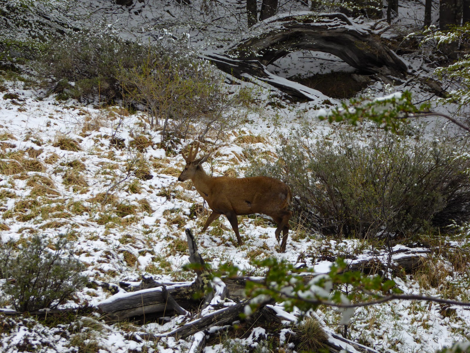
We returned that afternoon to Huaraz and the next day were up at 5am to start our Santa Cruz trek. Like Laguna 69, this trek goes through the Huascarán National Park in the Cordillera Blanca. The trek was amazing, with scenery reminiscent of Patagonia. The Cordillera Blanca has 33 peaks over 5500m and over 700 glaciers - there were magnificent snowy panoramas everywhere we looked.  We even saw Paramount Mountain; yes, the one in the Paramount Pictures logo! While easier than our ridiculous Machu Picchu trek, it was still challenging at times, particularly with the altitude. Day 2 took us up to a 4750m pass, the highest I have ever hiked to, and that day we camped at 4250m. Two sleeping bags still weren't enough to quite keep out the bitter cold; it's the highest we've slept at on the whole trip and the first time we've had ice inside the tent! We were lucky with the weather though, with clear skies most of the time allowing us stupendous views at both of the highest points.

Looking out on the Paramount Mountain
We were in a group of eight, all lovely people - an Aussie couple, two Israeli brothers, and an Aussie girl and Canadian girl travelling together - plus two guides, a donkey driver and several donkeys. And a dog, which ostensibly belonged to the donkey driver but was nameless and spent most of his time trekking with us. In fact he became rather overprotective, one night waking everyone up barking wildly and attempting to chase away nearby cows.

Kev with 'El Perro' ('The Dog') - we gave him a name!
On the last day of the trek we had a fairly easy walk downhill, next to a lovely river with so many waterfalls that we beat our record number in a day. Kev managed to fall over spectacularly on top of a cactus - the guide got to practise his first aid skills bandaging his hand and later extracting a cactus spine at least an inch long! We celebrated the end of the trek with beers at a shop in the tiny village at the end that was actually run by our guide's aunt and uncle.

One of numerous waterfalls along the river on day 4
That evening we were all also invited to the house of Orlando, the owner of the company, for delicious homecooked dinner and pisco sours, with a demonstration of the making of the latter. Orlando invited us on to the birthday party of one of his colleagues and we had a great evening drinking, chatting and watching the (somewhat odd) Peruvian style of dancing. We'd definitely recommend the Eco Ice company to anybody!

Our final campsite at Llamacorral 
There's plenty more to do here, and in fact we'd like to come back here on holiday in the future to do the challenging and perhaps even more impressive 10 - 12 day Huayhuash circuit in the other cordillera. But for now we're pushing on up north before we fly back down to Patagonia in 2 weeks' time to meet family and do yet more hiking!

Our trekking group at Punta Unión, the high pass on day 2 - new height record!