Showing posts with label birds. Show all posts

Thursday, 2 June 2016

The Biggest Bird You'll Ever See?

We'd seen several condors before on our trip, most notably during our trek towards Machu Picchu and several around El Chaltén, but never close enough to really appreciate their size. This time, while walking early in the morning, all alone in the Quebrada del Condorito national park, we saw two figures on a nearby hill. At first, we thought they were two more people, detracting from our uniqueness, but then they spread their wings and took off! They were enormous. They can have a wingspan of up to 3.3m and weigh up to 15kg.

Condor flying overhead at Quebrada del Condorito
This wasn't our last encounter with condors for the day. When we reached the quebrada (canyon), we saw several more circling overhead and some landing on the opposite cliff. Then, a group of about 15-20 decided to pass right above us before flying into the distance. It was an incredible experience to see them swoop over us one by one before disappearing behind the mountain.

The Quebrada del Condorito
The national park was our highlight of our time in and around Córdoba, Argentina's second city. We liked the city itself - it's an old colonial city and is home to our final World Heritage Site for Argentina. Of course, it was another Jesuit mission. We did a short tour around the church, and discovered that the surrounding buildings are home to the country's oldest university. As a major university city, it was home to many of the 'Disappeared' - those who were killed by the military dictatorship during the '70s and '80s.

The entrance to the Jesuit church
After a lot of time sitting in cars and wine tasting, we wanted to do some hiking, and handily there are several small mountain ranges just outside Córdoba - the Sierras. We visited the small town of Capilla del Monte in the Sierras Chicas (Small Sierras), home to Uritorco Hill. This was perfect for our needs - a day long hike with pleasant views over the town and the nearby reservoir. Before we arrived, we hadn't done much more research than that, and we soon found that the town is full of UFO spotters, 'magical' rocks and plastic pyramids full of 'mysteries'. In 1986, a scorched patch of ground was found and this was subsequently blamed on aliens. You can now watch some incredibly unrealistic videos online, or buy plenty of little green man dolls.

A 'mystical' pyramid in Capilla del Monte
After Córdoba, we set off for our final country on this continent - Uruguay. We'll stop in a couple of places on the way to break up the journey, but not spend much time there, before crossing the border to Fray Bentos.

Thursday, 12 May 2016

Manoeuvre, Mirror, (Maybe) Signal

Driving in Argentina is ...interesting. While not as crazy as, say, Colombia (let alone Asia), we have quickly learnt that things are quite different here than at home. Firstly, normal road rules don't really apply. At roundabouts and so on, the general rule seems to be whoever goes fastest, or is most pushy, has the right of way. And for Argentinian drivers, it isn't the usual mirror, signal, manoeuvre, but manoeuvre first, then have a look in the mirror and signal if you feel like it.

Galloping horse and llama! On the way to Cachi
Secondly, nearly all of the towns in the country (and in fact the whole continent) use a grid system of roads, but there are virtually no traffic lights. So every time you come to a junction, you have to slow down dramatically in case something comes shooting out in front of you. It's quite frustrating! Instead, the authorities opt to put traffic lights at seemingly random places where they are totally unnecessary. We got stopped at 10 different sets on a 5km stretch on the way out of Calilegua, all of them interminably long and completely redundant!

Roads / rivers, from the top of the pass going to Cachi
Thirdly, Argentina is FULL of police checks. We've noticed this on buses before - every so often, your bus will be stopped and police will come on board, search the bus, ask a few people for ID, etc. In the car, we realised just how many police stops there are! Literally every few km there would be police in the road, signalling at us to slow down. On 90% of occasions, they would wave us straight on again just as we'd nearly come to a halt, obviously recognising the standard tourist rental car (everyone renting a car here has exactly the same one - a Chevrolet Classic). We got stopped properly twice, and only once asked for any documents. The silly thing is, they didn't even want to see Kev's driving licence, only the rental car stuff and his passport! We met another English couple who'd shown the police their UK licences and been met with total confusion and asked for their passports instead. It would doubtless have been fine for me to drive then!

One of the many little chapels we passed along the roads in the north
The even more stupid thing police-wise is that at siesta time (roughly 12.30 - 4pm),  and any time after 7pm, the police all shut up shop and the roads are totally clear. It would thus seem obvious that if you were planning any dodgy dealings, you would just need to drive at siesta time or at night. How many drug smugglers, or whatever it is they are looking for, do they actually catch with these checks? We wonder why they bother with all this at all - perhaps it is just to provide lots of people with employment as roadside police officers!

Colourful mountains and lots of cacti! In Los Cardones National Park
Another issue that has made driving interesting, of course, is the road surfaces. A lot of places we've wanted to visit have been down pretty dodgy, unpaved gravel roads. On a couple of occasions, we heard a loud clank and got out, fearing the worst - massive dent, burst tyre, etc. One time we drove through a huge patch of mud, and the mud then gradually dried and came off the wheels, making a continuous spattering noise so we were we convinced we'd got something stuck in the wheel. Another time, we noticed a petrol smell inside the car, and after two days of this thought we must have got a small hole in the petrol tank. We took the car to a mechanic, who said it was just that the petrol tank had been overfilled. Phew. And on our last day with the car, we suddenly noticed two little clear marks, like water drops, on the windscreen, that weren't coming off with the windscreen wipers... Alarm bells rang - we were convinced we'd managed to chip the windscreen! Fortunately, when we got out to look, we discovered they were in fact just some tree sap that we could clean off. Big relief! The car is being picked up today, and as far as we can tell has survived its time with us unscathed. Let's hope the rental company agrees.

Pretty butterfly in Calilegua National Park
Enough about driving. What about the places we have visited in our last few days with the car? When Kev last wrote, we had just left the spectacular Quebrada de Humahuaca region, in the far north. Our next stopping point was Calilegua National Park, down at only 600m altitude and a totally different climate to the cold and aridity of Humahuaca. Calilegua encompasses a large, protected region of cloud forest and we had been looking forward to some hiking there. But alas, when we got to the national park, only 4 of the 10 hiking trails were open. The rest, including all of the longer ones, had been closed due to flooding a few weeks ago. We were disappointed, but made the best of things by doing a short walk linking together a couple of the trails that were open. Calilegua is a haven of biodiversity, especially with respect to birds - there are over 250 species here, and birdwatchers come from all over the country.  We heard plenty of birds, but saw very few in the park itself. Ironically, we saw more birds in the town that is the base for the park - several toucans and parrots in the trees!

Cactus filled plain and colourful mountains, in Los Cardones National Park 
From Calilegua, we drove all the way back down to Salta, and spent a night there before continuing on to the small village of Cachi, out to the west on the way to Cafayate via the scenic route. This was mostly along a paved road, luckily, with only 20-30km unmade. The road wound up to a 3500m pass, through fantastic scenery that began quite green and became more arid and desert like as we got higher. We passed through Los Cardones National Park, named for the Cardón cactus, of which there were loads! At one point it was just a huge plain, covered in cacti, and framed by the mountains in the distance. Pretty cool. Other parts of the journey took in some quite volcanic looking landscapes that reminded us of Pali Aike National Park in Chile.

Little cemetery in Cachi
Cachi itself was a very pleasant little village, extremely quiet during low season. I think we met most of the (5 or 6) tourists there on the first afternoon as we strolled around the centre! It's hard to say what was so great about Cachi, but we really liked it - it had an amazingly relaxed, sleepy feel, as well as being very pretty with its traditional adobe buildings and lovely little square. We didn't do much there, other than a couple of walks, one to get a view of the subdued, purple coloured mountains behind the village, and the second to a nice viewpoint of the village itself. It was beautiful seeing the bright green squares of some of the fields of crops down by the village, against the barren backdrop of the hills all around.

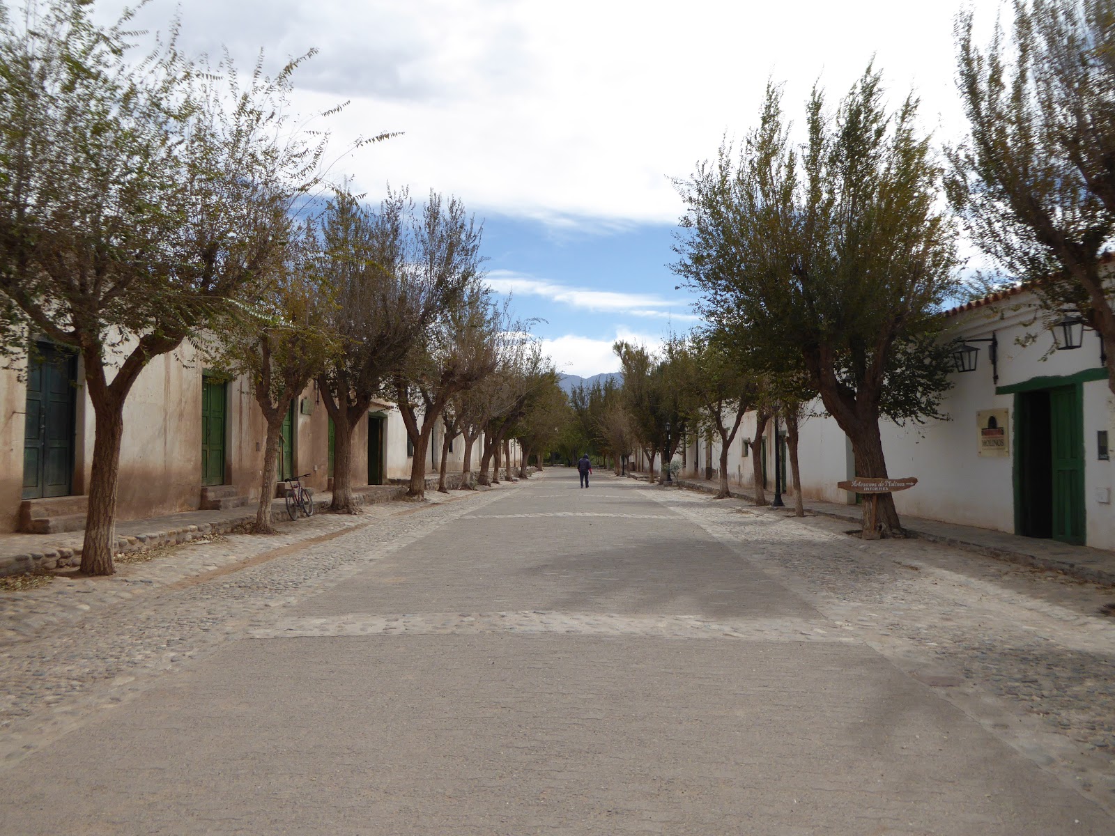
Pretty avenue in Molinos, en route from Cachi to Cafayate
In Cachi we met an older English couple on holiday, bemoaning the terrible state of the road from Salta. We didn't dare tell them that the roads got a lot worse in the north! We met them again in another small village, Molinos, the next day, on the way south to Cafayate. This trip from Cachi to Cafayate looked on the map like it wouldn't be too arduous - it was roughly the same distance as from Salta to Cachi (160km). However, we hadn't quite realised just how bad the road was. This was 160km down the Argentina's famous Ruta 40, which stretches all the way down the west of the country, nearly 5000km in total. We'd read plenty of horror stories about Ruta 40 when we were in Patagonia, but been pleasantly surprised - most of the road down that end had been paved since our guidebook was published.

On Ruta 40 heading towards Cafayate
Sadly, the same could not be said about this end of Ruta 40! While the road began in not too bad a state, it got progressively worse after we met the English couple again in Molinos, which is about 40km south from Cachi. The middle 60km or so of the road was dire. This was the section where we heard several loud bangs and feared the worst, and where we got mud all over the car! We actually passed a machine that was meant to be flattening the road surface, but all it was doing was pushing all the sand and stones into a heap in the middle, forcing you to remain on one side of the road at all times regardless of how bad it was.  Hmm. Still, the state of the road was mitigated by the absolutely breathtaking scenery, and eventually we made it to Cafayate, in a total of 6 hours. Everyone else we'd met in Cachi had also survived the road with their rental cars, so things could have been a lot worse!

Crazy rock formations along Ruta 40
Cafayate is famous for two things - wine, and a spectacular canyon (the Quebrada de las Conchas). We duly took advantage of both these things. On our first full day Kev had a break from driving and we spent the afternoon winetasting. Sounds idyllic, but was actually a little frustrating! We went out at around 1.30pm, and found ALL the wineries in town were closed for siesta until 3 or 4. The Argentinian siesta is a bit of a joke - it happens everywhere in the country, regardless of the weather (it's about 15 degrees in Cafayate at the moment) and regardless of any thought for business. Cafayate is a very touristy town, the tourists come to visit the wineries - but do they think to open the wineries all day? Nope. Only 10-12am and 3-5pm. They must be missing out on a ton of business.

El Esteco winery in Cafayate
We did eventually make it to 3 different wineries later in the afternoon. The wine here is excellent, especially the Malbec (for which Argentina is famous, obviously) and the Torrontés, a white grape variety we'd not come across before. The wine tastings though, were less excellent - the people working at the wineries clearly didn't care in the slightest about our being there. There was no enthusiasm, no information, no anything really! Just 'here's your wine, drink up'. There was also a bit of a lack of knowledge. We were sampling a Torrontés in the first winery, and I commented that it was quite dry and tasted similar to a Sauvignon Blanc. The guy looked confused, and, I kid you not, said that he had never heard of Sauvignon Blanc, and the only white wine they made there was Torrontés. How can you work in the wine industry and not have heard of one of the most famous varieties of white wine worldwide?! Pretty funny, we thought.

Pretty scenery our hike near Cafayate
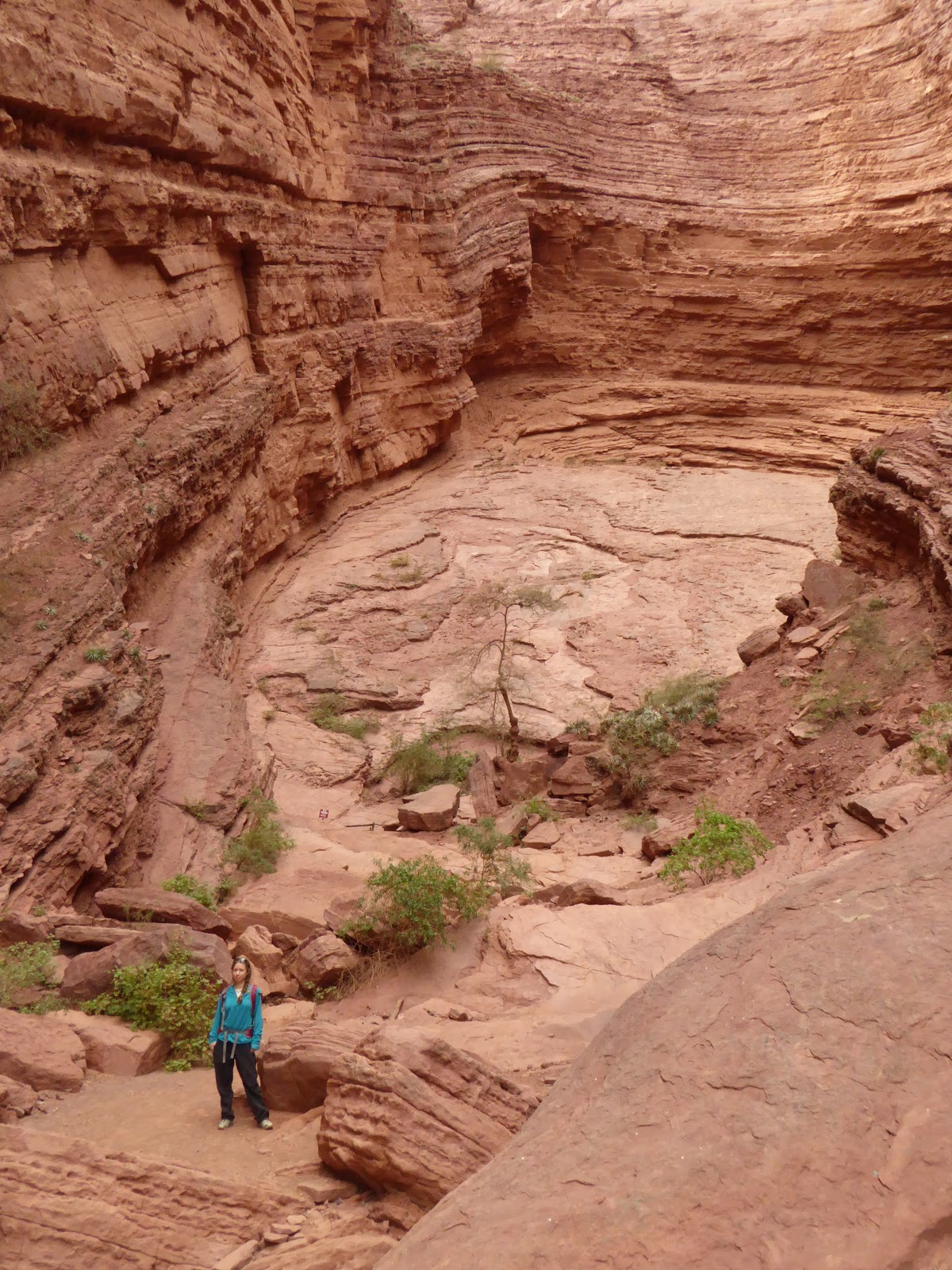
We also did a nice hike a few km out of town, up a small canyon passing several waterfalls. It was great fun - more of a rock climb in places than a walk! We were advised to get a guide, but decided to go it alone and enjoyed it all the more for the challenge of trying to work out where the path went. We also drove through the big canyon, the Quebrada de las Conchas, admiring the otherworldly landscapes. The scenery round Humahuaca was unbelievable, but this was equally so! Amazing formations of red sandstone, looking so much like slightly eroded pillars, pinnacles and other man-made features that it was hard to believe they were natural. The highlights were two huge hollows carved out of the rock, with layers upon layers of twisted rock forming two massive spaces like amphitheatres. The acoustics were incredible!

The Garganta del Diablo formation, in the Quebrada de las Conchas
We are still in Cafayate, planning to do another wine tasting or two today before we head south tomorrow. Where to is still to be decided. The problem is that none of the buses from Cafayate go where we want to - so we are going to have to rethink our route a little. We are still ultimately aiming for Mendoza, where we hope to reunite with our London friends Ralph and Shehnaaz in the next week or two.

Another lovely view in the Quebrada de las Conchas

Sunday, 17 April 2016

The Incredible Iguazú Falls

The Iguazú Falls - maybe one of the most famous sights in South America, and something we'd certainly heard of before we got to this continent! We'd both been looking forward to seeing this amazing set of waterfalls for the whole trip so far. Although we've had to skip most of Brazil in order to see everything else we want to see before June (we'll be returning one day!), Rio and Iguazú were the two places we really wanted to get to this time.

The Iguazú Falls from the Argentine side
The Iguazú Falls are on the Iguazú river, located right on the border between Brazil and Argentina. They are shared between the two countries - both sides have their own Iguazú National Park, and both of these are UNESCO World Heritage sites! The falls are not just one waterfall, but a huge set of 275 drops in total, ranging from 60 - 82m in height and extending for 2.7 km along the river. Two thirds of the falls are in Argentine territory, and the Argentine park is a lot bigger, but there are absolutely spectacular views from both sides. Eleanor Roosevelt is said to have remarked, on her first sight of the falls, 'Poor Niagara', and you can see why.

Panorama from the Brazilian side
When looking at places to stay near Iguazú, we remembered a recommendation we'd had a while ago. The English couple we did our crazy long Machu Picchu trek with, Ivonne and Robin, had mentioned a hotel that was located actually within the Brazilian national park itself, within 2 minutes walk from the falls and even with views of them from some of the rooms. We'd had this in the back of our mind for some time and couldn't resist looking into it. Even when we found it was way, way above our budget, we couldn't quite make ourselves relinquish our dream of staying there, and thus it was that we booked without doubt our biggest accommodation splurge of the trip so far - 3 nights in the 5 star Belmond Hotel Das Cataratas!

Champagne breakfast in front of our hotel
The hotel was amazing. We enjoyed all of its perks - the gym (after which we couldn't walk for days, haha), the beautiful pool, the bar (best pisco sour since Peru), the breakfast time champagne ... and even the room service (ironically because this was the cheapest way to eat - the two onsite restaurants were both quite unaffordable!). But without doubt the biggest perk of all was the proximity to the falls, and the exclusive access in the mornings and evenings when the park was closed to the public. We often had the falls completely to ourselves. We got our first view of the falls the evening we arrived, around sunset. The viewpoint was literally just opposite the hotel, and there were only a few other people around. WOW! I can't even attempt to describe the beauty of this moment - the photos will have to do the talking for me.

Our first view of the falls, from the viewpoint in front of our hotel
The next morning, we got up early and went to see the falls before the park opened to the public. While the day before we'd only seen the view from the first viewpoint, today we followed the path down towards Devil's Throat, the most famous waterfall. In a short 15 minute walk, we were greeted with one spectacular vista after another. It just got better and better! We hadn't really appreciated the sheer size and number of the waterfalls from the hotel viewpoint, and now could see them stretching much further than we'd realised. It was just avalanches of water in all directions. Unbelievable. Near the end of the path, there was a metal walkway out into the river around the top of some of the falls, from where we could look down and see the water suddenly just disappear over the edge of a cliff. We got totally soaked from all the mist! At the very end of the path, we arrived at a stunning view of the Devil's Throat, the biggest waterfall of them all. I could have stood there all day, watching the tons of water come hurtling down and hearing the incredible thundering noise. Again, WOW.

The misty walkway near the Devil's Throat
After three nights, we reluctantly left our nice hotel. We weren't done with the falls yet though and were headed next over the border to Argentina, to see them from the other side. En route, we visited Brazil's Parque das Aves (Bird Park), which is right next to the national park entrance. We'd read mixed reviews of this but loved it and were very glad we went! They have a huge collection of birds, mostly from the Amazon region. Yes, they were in captivity, but most had been rescued from much worse situations, and the enclosures seemed large and not too crowded. We saw so many weird and wonderful birds that we'd never have got to see otherwise. Among my favourites were the three or four different species of toucan, the harpy eagles, and the gigantic walk-in enclosure with eight different types of macaw flying / perching everywhere!

Green-billed toucan in Parque das Aves
We'd been quite looking forward to returning to Argentina. It's a country we feel we know fairly well by now, after spending quite a lot of time here previously. But unfortunately, on our first evening in the country, we had a bad experience that somewhat tarred our formerly positive feeling about returning. As we were walking back to our hostel after dinner, we passed a house with a dog behind a closed gate. It came running, barking, and threw itself at the gate. A lot of dogs here behave like this, so we were unperturbed, until another dog appeared from nowhere, ran at us and bit me on the leg! This dog turned out to belong to the same house, but had been left loose in the street.

Scarlet macaws, with one blue-and-yellow one, in the Parque das Aves
The bite wasn't too bad; it swelled up a bit and looked like a red weal but didn't properly break the skin (now, several days later, it is just a very impressive bruise). However, worse than the bite itself was the attitude of the owner. She would not admit the dog was dangerous, would not agree that it shouldn't be left to roam freely on the street, would not even apologise until the neighbours too, who had seen the whole thing and whose Spanish was obviously a lot better than ours, got involved. What a rude, unpleasant person! The neighbours did not seem to like her either - when she'd gone, they apologised on her behalf even though it was in no way their fault, and told us the same dog had bitten someone before. Fortunately most Argentinians we've met have been super friendly and nice; the opposite of this woman. It was a horrible thing to happen on our first day back in Argentina though.

View of the San Martín waterfall, on the Argentine side of the falls
This incident meant we changed our plans a little and stayed an extra night in Puerto Iguazú so I could get the bite checked by a doctor (various doctor friends at home had advised this just in case of any risk of rabies). It was very easy, and not too expensive, to see a doctor at the private clinic, and she reassured us the bite should be fine, and that rabies is controlled in Argentina. Rather than going to the national park after this, we decided it was too late and instead went to visit an animal rescue sanctuary nearby. All the animals here were from the jungle regions of Argentina and had been rescued from appalling conditions, often being kept as pets in tiny cages. So it was sad seeing some of the birds missing eyes or legs, or unable to fly, but also positive that they are now being looked after well.

Part of the Itaipú Dam in Brazil
On our second day in Argentina, we actually crossed back over the border to Brazil so that we could visit the Itaipu Dam there. The dam is on the river that divides Brazil and Paraguay, and is huge - 7km long and around 200m high. It was built as a joint venture between the two countries, and the hydroelectric power it produces supplies both Brazil and Paraguay with a significant proportion of their electricity. In fact, Brazil is so much bigger than Paraguay that it pays the latter around a million dollars a day to use more of the dam's turbines. So Brazil takes 90% of the power produced, and Paraguay 10%. Despite this, in 2013, the dam supplied 75% of Paraguay's electricity, and 17% of Brazil's. It was cool to see the dam, though I think we got more from reading about if afterwards than from the very touristy open top bus tour we did.

In front of the Devil's Throat, Argentine side
Finally, on our third day in Argentina, we made it to the Argentine side of the falls. We were glad we'd saved this till last, as it was even better than the Brazilian side! The national park is a lot bigger, and we spent the whole day there walking along several different trails. On this side, we could get a lot closer to most of the waterfalls, and see them both from above and below. As it was a sunny day, there were rainbows everywhere! We also got the best panoramic view yet, with the falls continuing as far as we could see. Argentina also seemed to win on the butterfly front. There'd been a few on the Brazilian side, but here was another level! We had to walk through literally clouds of them. It was impossible to escape; they were EVERYWHERE. All shapes, sizes and colours and all, it seemed, constantly wanting to land on human beings! This was a massive challenge for me but my desire to see the falls overcame my fear (mostly); I did spend a lot of time swearing, running through the biggest clouds and flapping my hat / bag at them though!

One of several big clumps of butterflies.These would fly up into the air all around us when we passed!
The highlight of the Argentine side was another view of the Devil's Throat. This time, we got much closer to it, and could hear its roar from several hundred metres away, increasing as we approached. Quite a large proportion of the total volume of water in the falls is funneled down this one narrow chasm, and the sheer force of it is astounding. I can't describe just how exhilarating it was to stand there, getting completely drenched, and marvelling at this gigantic torrent of water throwing itself down right next to us. No other waterfall I've ever seen comes anywhere near the magnificence of this spectacle! Once again, we felt utterly awed by the power of nature.

Panorama of the Devil's Throat and surrounding waterfalls, Argentine side
We've now (unwillingly) left the Iguazú area, and will spend a bit more time in Argentina before we move on to Paraguay. The take home message from this post though is - go to the Iguazú Falls! If it's not on your bucket list, it should be.

Friday, 25 March 2016

Sea Turtles in Suriname

We got up early for our bus from Guyana to Suriname at 5am. Too early, as it turns out, as it arrived at 6, before bouncing along the road to Moleson Creek. This small town is on the Courantyne River, which forms the border with Suriname. We stamped out of the country here, and boarded a car ferry to take us the 30 minutes to the other side.

The immigration process on the other side can be a very slow affair - locals in the know sprint off the boat to get in line first. We adopted this policy - several of us walking quickly, keeping just behind the border guard leading the way. Jo sabotaged one guy ahead of us by accidentally standing on his flip-flop, and we got a prized spot near the front of the line. We got through quickly, but then had to wait for an hour or so as the other people in our bus took their time to get past the queue. We finally arrived in Paramaribo, the Surinamese capital, 12 hours after we'd set off.

The palm garden in Paramaribo
Paramaribo, for us, wasn't the most appealing of cities. There are plenty of white, balconied colonial houses along a few streets near the Suriname River, a small fort and a public garden filled with hundreds of tall palm trees. On Sunday mornings, people get together to have birdsong competitions where they pit their prized 'twatwas' against each other. Unfortunately, the timing didn't work out for us to see this. We did see lots of people carrying birdcages around during the week though! Apart from that, we found the city a little lacking in soul. It was pretty quiet and felt a lot more like a small country town than a capital city. It's very spread out and most people have cars to get around. We found it very difficult to find essentials like grocers and pharmacies - there didn't seem to be any in the centre at all. Although almost every shop calls itself a 'supermarket', they are more like corner shops and don't stock fresh produce, which limited our ability to cook for ourselves.

Colonial buildings and cars in Paramaribo
Apart from the capital city, the other things to do in Suriname are go to the jungle (moth-y) or go to a sea turtle nesting site. We opted for the latter, but baulked at the 175 Euros quoted by tour agencies for a single night. Instead, we took a bus to Albina, the border town with French Guiana, then negotiated a small boat to take us the 2 hours down the river estuary to Christaankondre. This is a village at the mouth of the river, close to the Atlantic Ocean, which is completely cut off from the rest of the country except by boat. We took a basic room in the only place to stay and joined a small tour group to go and see the turtles that night.

Christiaankondre - in the middle of nowhere
We were rewarded with a full moon giving us great light to search for turtle tracks along the beach. This is the easiest way to find them as at the top of the trail they dig a hole to lay in while laying their eggs. They lay between 100-200, then bury them in sand and dash back to the sea. We found several turtles, and they were enormous - maybe 2 metres in length. We saw every stage in the process: the finding a suitable spot and clearing it; the digging the hole; the laying; the burying; and the dash back to sea We also saw a couple of people in this very remote area who were probably stealing the eggs to sell. Although the beaches here have a nominal guard, it is very easy to go there when the guards are not.

The back of a green turtle laying eggs
The next morning, we found another boat to take us back to Albina, the border town. We took yet another boat across the Maroni River into French Guiana. The border process on either side was the most lax we've seen anywhere in the world, and this time there were no queues to negotiate! We are going to spend about a week in this French territory, before flying into Brazil.

Monday, 21 March 2016

A Very Smelly City

We departed Curaçao late in the evening, after a great few days there. As we mentioned previously, one of our main reasons for visiting was to use it as a stop off point between Colombia and Guyana, thus avoiding Venezuela. We found there was a cheap daily flight from Curaçao to Georgetown, the Guyanese capital, with InselAir.

Georgetown, viewed from the air
What we didn't realise when we booked this flight, was how notoriously bad InselAir is. As it is one of the only carriers offering short hops around the Caribbean and the north coast of South America, it has a bit of a monopoly. It seems this means it can run its flights whenever it wants, and the scheduled times mostly bore no resemblance to the actual departures!  Our flight was meant to leave at 9:30 pm, the last of the evening from Curaçao. It actually went at 11:10 pm, from a different departure gate. The time and departure was announced suddenly - up till then we'd heard nothing about it. We were quite fortunate it seems, as three other InselAir flights scheduled to leave before ours had not even arrived when we were boarding. Art, our host in Curaçao, told us the InselAir flights are always like this!

St George's Cathedral, in Georgetown
Anyway, we eventually arrived safely in Georgetown at 1am. We had been a little worried that our taxi pick up would not be there, or the driver would be an axe-murderer (safety is quite an issue in Georgetown, especially late at night). However, all went smoothly. Other than the fact that the airport is not in fact in Georgetown but out in the jungle nearly an hour's drive away... hence it was full of moths. BIG ones. Like, the biggest moths I've ever seen, all at once. It was a complete nightmare for me, and when we got in the taxi and there was one inside, I nearly had a heart attack! Luckily, once in the city, moth sizes / numbers became a lot more manageable.

Interior of St George's Cathedral
Guyana is probably the least well known and the least travelled country in all of South America. This little nation, with a population of only 750,000 people, used to be a British colony and only became independent in 1966. The British influence is evident in several respects: the official language is English (it's the only country on the continent that speaks English as its first language), they drive on the left hand side of the road, they are passionate about cricket, and they are fond of tea (in teapots). Oh, and the local beer, Banks Beer, first brewed while Guyana was still a British colony, is probably the best national lager we've had in South America. The country is also very multicultural - another legacy of the British, who brought slaves over from Africa and indentured labourers from India. The largest ethnic groups today are East Indian and African. It is the poorest country in South America, behind Bolivia and Paraguay, and the local currency is the Guyanese dollar, of which there are about 300 to a pound. It's quite entertaining when you hear that your dinner will be 1000 dollars! Given that it is so poor, it seems strange how expensive it is - just a few days here will severely dent a backpacker's budget, we found out.

The City Hall in Georgetown
When we arrived in Georgetown itself, the first thing that hit us was the smell... not in a good way! The city has open sewers, is very dirty, and all water channels / rivers are literally black. Everywhere stinks of poo. However, we got used to this fairly quickly! Georgetown also has a reputation for being unsafe, as I mentioned - there is a high incidence of petty crime and certain areas are definite no-go zones for tourists. We were a little nervous at first to just walk around on our own, but our host said it would be fine, so we spent a lot of time just strolling round the city absorbing the atmosphere. We had no problems at all; in fact. on the contrary, people were mostly pretty friendly and curious to see white faces. While Georgetown has quite a gritty feel to it, we enjoyed it, as it is just so completely different to anywhere else in South America. It was great seeing Asian shops everywhere, hearing English spoken (albeit in a Caribbean accent we often couldn't understand!), watching cricket with locals, and hearing Indian-influenced styles of music.

The 1763 Monument, in Revolution Square
We explored the city over 2 days. There aren't many attractions, but the huge wooden cathedral, St George's, was quite impressive. It is apparently the largest wooden church in the world - the locals are quite proud of this! We also visited the City Hall, another colonial wooden structure, decaying somewhat but still very nice; the National Library; and the National Museum. The museum's main exhibition was about Guyana's big festival here, Mashramani, which takes place in February every year to commemorate the anniversary of the country becoming a republic. The photos and costumes on display, and the excitement of local people when discussing this, suggested this country does have one thing in common with the rest of the continent - it loves its carnival! Another day, we walked over to Revolution Square, where there is an interesting African themed memorial to a slave revolt that took place here in 1763. Passing the Botanical Gardens and Zoo en route here we randomly saw two beautiful macaws flying right overhead, reminding us just how close to the jungle Georgetown really is.

Old fashioned adverts lining Georgetown's sea wall... They even had a Marmite advert!
We had planned to go straight from Georgetown over the border to Suriname. Suriname is the only country for which we need a visa - well, a 'tourist card' for us as UK citizens. The process of applying for this was a little complicated. First we had to go to the Surinamese embassy, which was cunningly concealed in a posh residential area of Georgetown. We spent a while walking around looking for it, and eventually located it with the help of some locals. The security guard at the embassy asked us, did we have a photocopy of our passport photo pages? Forewarned about this, we said yes. Did we have a photocopy of our Guyana entry stamp page? Erm, no. Did we have 35 US dollars each? Erm no, but we had $25, which was what it had cost last week. The lady packed us off to change some more Guyanese dollars into USD, and get the other photocopy. We later found out the charge for the tourist card had gone up only 2 days ago - doh!

Aerial view of the jungle near Kaieteur Falls
When we returned to the embassy with all we needed, the security lady finally let us into the office itself. The lady at the desk there told us we'd need to leave our passports and come and pick them up again that afternoon. We couldn't do that, we said, as we had a tour booked that afternoon. We asked if we could come back the following morning instead (Friday). Well, the office MIGHT be closed, she said, as there MIGHT be a national holiday. Could she find out, we asked. No, no-one knew, apparently. There were some local elections happening and the embassy staff didn't yet know if they'd be working or not! We grew steadily more frustrated as we knew the embassy would definitely be shut at the weekend. Eventually we pestered her enough that she managed to get our tourist cards issued straight away! Not sure why you normally have to wait until the afternoon...

At Kaieteur Falls
The reason we couldn't go back to the embassy that afternoon was that we had booked ourselves on a trip to Kaieteur Falls, perhaps Guyana's most spectacular natural attraction. The majority of the country is pristine jungle (well, with the odd gold mine), and the Kaieteur waterfall is deep in the interior, hidden in the rainforest. The only option for getting there, other than a 5 day hike, is a short flight in a small 12 seater plane. It was an expensive tour, but 100% worth it! We flew for an hour over a sea of trees, seeing nothing but this huge expanse of green for miles and miles, interrupted only by the muddy brown rivers snaking their way across the country. As we neared our landing point, the pilot made a big turn, and we had our first sight of the Kaieteur Falls. Wow!

The beautiful Kaieteur Falls
We landed at an airstrip literally in the middle of the jungle, and had 2 hours on a guided walk that took us to three different viewpoints of the falls. It has to be one of the most spectacular in the world, not just for its size (the highest single drop waterfall in the world) but for its stunning setting. The waterfall drops from a rocky outcrop, and all around is rainforest. The power of the water was incredible, even though our guide told us it was currently only about 60% full due to the recent dry weather. In the mist around the falls we could see rainbows. I'm so glad we made it here, as it was really something special. We didn't want to leave, and wished the other tourists who accompanied us on the flight would stop taking photos occasionally so we could just gaze in peace for longer!

Rainbows in the mist
While there is doubtless plenty more to see and do in Guyana, chiefly jungle-based adventures, we are trying to push on through these three little countries at the top of the continent. The prices here are high, and we still have a lot more to squeeze in before we return home in June. So for now, it's goodbye Guyana, as we head on to Suriname (a gruelling 12 hour bus-boat-bus-bus journey, more on that next entry!)

View down the valley from the bottom of the falls

Friday, 15 January 2016

Birthday on the Caribbean Coast

We left Pasto to fly up to Cartagena, a UNESCO listed colonial city on the Colombian Caribbean coast. We were going as our friends, Cindy and Julien, with whom we'd travelled in Chile and Bolivia, were going to be there having just arrived from Cuba. It was great to see them again and exchanging tales of our travels in the intervening six months. It was also my birthday and we celebrated with Indian food and craft beer, which I enjoyed a lot!

In the craft beer pub for my birthday
Cartagena was a big change on many levels - altitude, heat, people, music, etc. It was almost the first time on our trip that the climate was actually hot. We'd mostly been in the Andes along the length of the continent, and although the days could be quite warm, the evenings and nights were refreshingly cool. Now, the heat was relentless and we were glad for the air conditioning in the room.

Old and new - skyscrapers and city walls in Cartagena
The other marked differences were the ethnicity and the music being played everywhere. There's a much more racially diverse mix than we've seen in the rest of South America, and the music follows on from that. Although you still hear the same stuff as in the rest of the continent, there's more variety here with a lot of Caribbean influence. It makes a nice change!

The main fort in Cartagena
The city itself was the principal Spanish port and access point to South America in colonial times, founded in 1533. As well as exporting gold and precious metals, many slaves were brought there to work in the colony. This made a significant contribution to the diversity seen today. Now it is a beautiful city, with each narrow street making a picture postcard of flowered balconies and cobbled streets, frequently roamed by horse and carts. It is surrounded by large city walls and looked over by an impregnable castle (the British tried to invade several times and were repulsed on each occasion).

Horse and cart on a typical Cartagena street
Cartagena was linked to the interior of the continent by river to the city of Mompox. This river was neglected in the 19th century, and became silted up, which led to the decline of the latter. However, this has left a sleepy town full of streets similar to those in Cartagena, but without the crowds of people and tourists. We spent a couple of days here, adjusting to the slow pace of life and taking a boat trip through matted reed beds with heron's heads poking out of the top.

The Magdalena River in sleepy Mompox
Since Mompox we've returned to the coast to Taganga - in stark contrast to Mompox, it is a hive of backpackers and cheap diving courses.