Showing posts with label hike. Show all posts

Thursday, 2 June 2016

The Biggest Bird You'll Ever See?

We'd seen several condors before on our trip, most notably during our trek towards Machu Picchu and several around El Chaltén, but never close enough to really appreciate their size. This time, while walking early in the morning, all alone in the Quebrada del Condorito national park, we saw two figures on a nearby hill. At first, we thought they were two more people, detracting from our uniqueness, but then they spread their wings and took off! They were enormous. They can have a wingspan of up to 3.3m and weigh up to 15kg.

Condor flying overhead at Quebrada del Condorito
This wasn't our last encounter with condors for the day. When we reached the quebrada (canyon), we saw several more circling overhead and some landing on the opposite cliff. Then, a group of about 15-20 decided to pass right above us before flying into the distance. It was an incredible experience to see them swoop over us one by one before disappearing behind the mountain.

The Quebrada del Condorito
The national park was our highlight of our time in and around Córdoba, Argentina's second city. We liked the city itself - it's an old colonial city and is home to our final World Heritage Site for Argentina. Of course, it was another Jesuit mission. We did a short tour around the church, and discovered that the surrounding buildings are home to the country's oldest university. As a major university city, it was home to many of the 'Disappeared' - those who were killed by the military dictatorship during the '70s and '80s.

The entrance to the Jesuit church
After a lot of time sitting in cars and wine tasting, we wanted to do some hiking, and handily there are several small mountain ranges just outside Córdoba - the Sierras. We visited the small town of Capilla del Monte in the Sierras Chicas (Small Sierras), home to Uritorco Hill. This was perfect for our needs - a day long hike with pleasant views over the town and the nearby reservoir. Before we arrived, we hadn't done much more research than that, and we soon found that the town is full of UFO spotters, 'magical' rocks and plastic pyramids full of 'mysteries'. In 1986, a scorched patch of ground was found and this was subsequently blamed on aliens. You can now watch some incredibly unrealistic videos online, or buy plenty of little green man dolls.

A 'mystical' pyramid in Capilla del Monte
After Córdoba, we set off for our final country on this continent - Uruguay. We'll stop in a couple of places on the way to break up the journey, but not spend much time there, before crossing the border to Fray Bentos.

Thursday, 12 May 2016

Manoeuvre, Mirror, (Maybe) Signal

Driving in Argentina is ...interesting. While not as crazy as, say, Colombia (let alone Asia), we have quickly learnt that things are quite different here than at home. Firstly, normal road rules don't really apply. At roundabouts and so on, the general rule seems to be whoever goes fastest, or is most pushy, has the right of way. And for Argentinian drivers, it isn't the usual mirror, signal, manoeuvre, but manoeuvre first, then have a look in the mirror and signal if you feel like it.

Galloping horse and llama! On the way to Cachi
Secondly, nearly all of the towns in the country (and in fact the whole continent) use a grid system of roads, but there are virtually no traffic lights. So every time you come to a junction, you have to slow down dramatically in case something comes shooting out in front of you. It's quite frustrating! Instead, the authorities opt to put traffic lights at seemingly random places where they are totally unnecessary. We got stopped at 10 different sets on a 5km stretch on the way out of Calilegua, all of them interminably long and completely redundant!

Roads / rivers, from the top of the pass going to Cachi
Thirdly, Argentina is FULL of police checks. We've noticed this on buses before - every so often, your bus will be stopped and police will come on board, search the bus, ask a few people for ID, etc. In the car, we realised just how many police stops there are! Literally every few km there would be police in the road, signalling at us to slow down. On 90% of occasions, they would wave us straight on again just as we'd nearly come to a halt, obviously recognising the standard tourist rental car (everyone renting a car here has exactly the same one - a Chevrolet Classic). We got stopped properly twice, and only once asked for any documents. The silly thing is, they didn't even want to see Kev's driving licence, only the rental car stuff and his passport! We met another English couple who'd shown the police their UK licences and been met with total confusion and asked for their passports instead. It would doubtless have been fine for me to drive then!

One of the many little chapels we passed along the roads in the north
The even more stupid thing police-wise is that at siesta time (roughly 12.30 - 4pm),  and any time after 7pm, the police all shut up shop and the roads are totally clear. It would thus seem obvious that if you were planning any dodgy dealings, you would just need to drive at siesta time or at night. How many drug smugglers, or whatever it is they are looking for, do they actually catch with these checks? We wonder why they bother with all this at all - perhaps it is just to provide lots of people with employment as roadside police officers!

Colourful mountains and lots of cacti! In Los Cardones National Park
Another issue that has made driving interesting, of course, is the road surfaces. A lot of places we've wanted to visit have been down pretty dodgy, unpaved gravel roads. On a couple of occasions, we heard a loud clank and got out, fearing the worst - massive dent, burst tyre, etc. One time we drove through a huge patch of mud, and the mud then gradually dried and came off the wheels, making a continuous spattering noise so we were we convinced we'd got something stuck in the wheel. Another time, we noticed a petrol smell inside the car, and after two days of this thought we must have got a small hole in the petrol tank. We took the car to a mechanic, who said it was just that the petrol tank had been overfilled. Phew. And on our last day with the car, we suddenly noticed two little clear marks, like water drops, on the windscreen, that weren't coming off with the windscreen wipers... Alarm bells rang - we were convinced we'd managed to chip the windscreen! Fortunately, when we got out to look, we discovered they were in fact just some tree sap that we could clean off. Big relief! The car is being picked up today, and as far as we can tell has survived its time with us unscathed. Let's hope the rental company agrees.

Pretty butterfly in Calilegua National Park
Enough about driving. What about the places we have visited in our last few days with the car? When Kev last wrote, we had just left the spectacular Quebrada de Humahuaca region, in the far north. Our next stopping point was Calilegua National Park, down at only 600m altitude and a totally different climate to the cold and aridity of Humahuaca. Calilegua encompasses a large, protected region of cloud forest and we had been looking forward to some hiking there. But alas, when we got to the national park, only 4 of the 10 hiking trails were open. The rest, including all of the longer ones, had been closed due to flooding a few weeks ago. We were disappointed, but made the best of things by doing a short walk linking together a couple of the trails that were open. Calilegua is a haven of biodiversity, especially with respect to birds - there are over 250 species here, and birdwatchers come from all over the country.  We heard plenty of birds, but saw very few in the park itself. Ironically, we saw more birds in the town that is the base for the park - several toucans and parrots in the trees!

Cactus filled plain and colourful mountains, in Los Cardones National Park 
From Calilegua, we drove all the way back down to Salta, and spent a night there before continuing on to the small village of Cachi, out to the west on the way to Cafayate via the scenic route. This was mostly along a paved road, luckily, with only 20-30km unmade. The road wound up to a 3500m pass, through fantastic scenery that began quite green and became more arid and desert like as we got higher. We passed through Los Cardones National Park, named for the Cardón cactus, of which there were loads! At one point it was just a huge plain, covered in cacti, and framed by the mountains in the distance. Pretty cool. Other parts of the journey took in some quite volcanic looking landscapes that reminded us of Pali Aike National Park in Chile.

Little cemetery in Cachi
Cachi itself was a very pleasant little village, extremely quiet during low season. I think we met most of the (5 or 6) tourists there on the first afternoon as we strolled around the centre! It's hard to say what was so great about Cachi, but we really liked it - it had an amazingly relaxed, sleepy feel, as well as being very pretty with its traditional adobe buildings and lovely little square. We didn't do much there, other than a couple of walks, one to get a view of the subdued, purple coloured mountains behind the village, and the second to a nice viewpoint of the village itself. It was beautiful seeing the bright green squares of some of the fields of crops down by the village, against the barren backdrop of the hills all around.

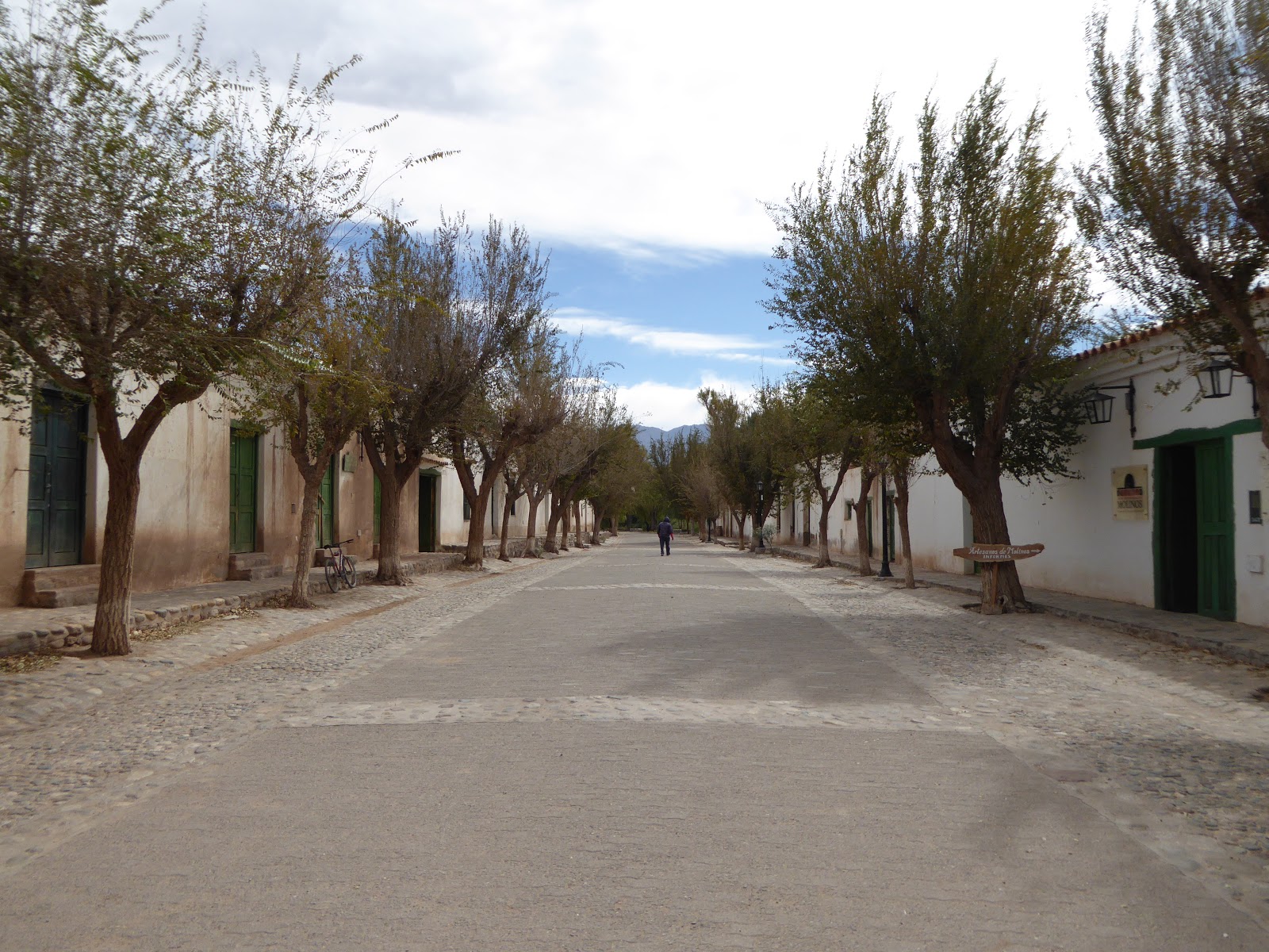
Pretty avenue in Molinos, en route from Cachi to Cafayate
In Cachi we met an older English couple on holiday, bemoaning the terrible state of the road from Salta. We didn't dare tell them that the roads got a lot worse in the north! We met them again in another small village, Molinos, the next day, on the way south to Cafayate. This trip from Cachi to Cafayate looked on the map like it wouldn't be too arduous - it was roughly the same distance as from Salta to Cachi (160km). However, we hadn't quite realised just how bad the road was. This was 160km down the Argentina's famous Ruta 40, which stretches all the way down the west of the country, nearly 5000km in total. We'd read plenty of horror stories about Ruta 40 when we were in Patagonia, but been pleasantly surprised - most of the road down that end had been paved since our guidebook was published.

On Ruta 40 heading towards Cafayate
Sadly, the same could not be said about this end of Ruta 40! While the road began in not too bad a state, it got progressively worse after we met the English couple again in Molinos, which is about 40km south from Cachi. The middle 60km or so of the road was dire. This was the section where we heard several loud bangs and feared the worst, and where we got mud all over the car! We actually passed a machine that was meant to be flattening the road surface, but all it was doing was pushing all the sand and stones into a heap in the middle, forcing you to remain on one side of the road at all times regardless of how bad it was.  Hmm. Still, the state of the road was mitigated by the absolutely breathtaking scenery, and eventually we made it to Cafayate, in a total of 6 hours. Everyone else we'd met in Cachi had also survived the road with their rental cars, so things could have been a lot worse!

Crazy rock formations along Ruta 40
Cafayate is famous for two things - wine, and a spectacular canyon (the Quebrada de las Conchas). We duly took advantage of both these things. On our first full day Kev had a break from driving and we spent the afternoon winetasting. Sounds idyllic, but was actually a little frustrating! We went out at around 1.30pm, and found ALL the wineries in town were closed for siesta until 3 or 4. The Argentinian siesta is a bit of a joke - it happens everywhere in the country, regardless of the weather (it's about 15 degrees in Cafayate at the moment) and regardless of any thought for business. Cafayate is a very touristy town, the tourists come to visit the wineries - but do they think to open the wineries all day? Nope. Only 10-12am and 3-5pm. They must be missing out on a ton of business.

El Esteco winery in Cafayate
We did eventually make it to 3 different wineries later in the afternoon. The wine here is excellent, especially the Malbec (for which Argentina is famous, obviously) and the Torrontés, a white grape variety we'd not come across before. The wine tastings though, were less excellent - the people working at the wineries clearly didn't care in the slightest about our being there. There was no enthusiasm, no information, no anything really! Just 'here's your wine, drink up'. There was also a bit of a lack of knowledge. We were sampling a Torrontés in the first winery, and I commented that it was quite dry and tasted similar to a Sauvignon Blanc. The guy looked confused, and, I kid you not, said that he had never heard of Sauvignon Blanc, and the only white wine they made there was Torrontés. How can you work in the wine industry and not have heard of one of the most famous varieties of white wine worldwide?! Pretty funny, we thought.

Pretty scenery our hike near Cafayate
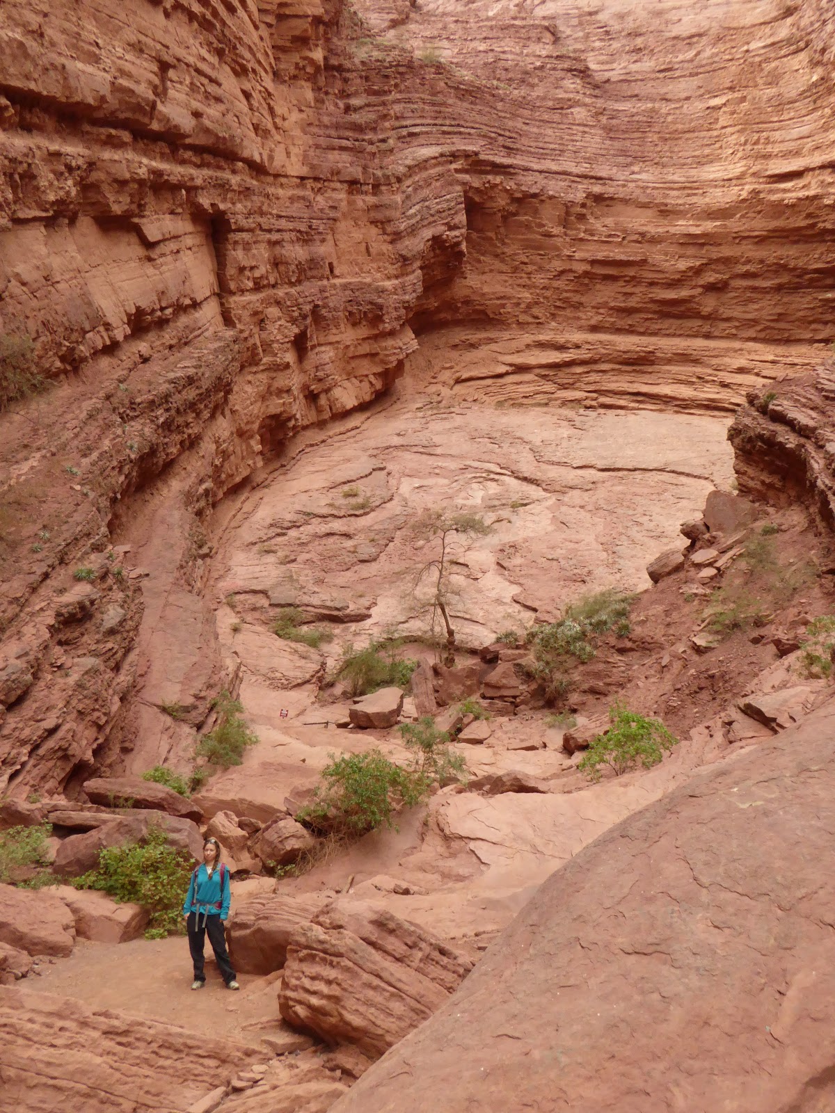
We also did a nice hike a few km out of town, up a small canyon passing several waterfalls. It was great fun - more of a rock climb in places than a walk! We were advised to get a guide, but decided to go it alone and enjoyed it all the more for the challenge of trying to work out where the path went. We also drove through the big canyon, the Quebrada de las Conchas, admiring the otherworldly landscapes. The scenery round Humahuaca was unbelievable, but this was equally so! Amazing formations of red sandstone, looking so much like slightly eroded pillars, pinnacles and other man-made features that it was hard to believe they were natural. The highlights were two huge hollows carved out of the rock, with layers upon layers of twisted rock forming two massive spaces like amphitheatres. The acoustics were incredible!

The Garganta del Diablo formation, in the Quebrada de las Conchas
We are still in Cafayate, planning to do another wine tasting or two today before we head south tomorrow. Where to is still to be decided. The problem is that none of the buses from Cafayate go where we want to - so we are going to have to rethink our route a little. We are still ultimately aiming for Mendoza, where we hope to reunite with our London friends Ralph and Shehnaaz in the next week or two.

Another lovely view in the Quebrada de las Conchas

Sunday, 10 April 2016

Rio de Janeiro

A horrendous set of flights took us from French Guiana to Rio. We left Cayenne at 5:30pm in order to spend 8 hours in the airport in the northern Brazilian city of Belém. We left there at 3am for Belo Horizonte before a final, hour long, flight to our destination. It seems that this is common in Brazil - our later journey to Foz do Iguaçu would also require three flights.

Rio from Corcovado
Rio is a beautiful city, best seen from its many heights. Or from its beaches. Or from street level. We shared our time between all of these, hitting all of the major sights - Sugarloaf Mountain, Christ the Redeemer, Copacabana, Ipanema... It's strange to be in a place where you already know all of the names and sights, but this doesn't detract from the experience at all.

Copacabana Beach
Half of the city is set along Guanabara Bay and the rest along the Atlantic coast. We walked down from the hilly Santa Teresa area, where we were staying, to Flamengo beach where we received our first view of the classic Rio scenery. A long, lively beach filled with people playing beach volleyball and football, sloping down to the bay and the distinctive hills on the other side. Around the corner is Copacabana beach, and we climbed the hill at the end to Leme fort. There were great views of the sweep of the beach, but also to Sugarloaf on the other side. Copacabana is separated from Ipanema beach by a headland, and we spent several evenings sitting on the bare rock here to enjoy the sunset.

Sunset over Ipanema Beach
Although we enjoy walking, it's not possible to get to the top of Sugarloaf without rock climbing or taking the cable car. We took the cable car, first to the accompanying hill Morro de Urca, then to the top of Sugarloaf itself. Unfortunately, we'd picked a day when the top was covered in cloud. No matter - the sunset views from Urca over Botafogo and Guanabara Bay were spectacular, and Sugarloaf was lit beautifully.

The cable car to Sugarloaf Mountain
Most people ascend Corcovado to visit the iconic art deco statue of Jesus by train or minibus, but we'd heard that it's possible to walk up. We started in Parque Lage and made our way up the 700m ascent, which got gradually steeper and slipperier. At one point we had to use a chain pinned to the cliff to get up a particularly precarious part. The effort was worth it - the views at the top over the whole of the city are unmissable. We took the train down.

Worshipping at Christ the Redeemer
Rio is currently preparing to host the Olympics and, therefore, is busy building and renovating everything. From what we saw, there will be plenty that is pushed right up to the wire. There are some new trams being prepared in the city centre, but the tracks are still being laid; and some buildings (the National Library, for example) were receiving facelifts, but political infighting has led to all work being stopped. This has left important parts of the city's architecture covered in scaffolding and sheets for one of its biggest events.

Olympic City sign next to Rio's newest museum, the 'Museum of the Future'
On many of the hills, and integrated with the rest of the city, are the favelas - inner city slums. There are lots of companies offering tours in many shapes and forms, but we decided against any of them. We're sure that many of the companies operate very ethically, but there are plenty that don't as well. Because of the tight integration of the poorer areas, Rio can be quite a dangerous city. We were followed by some assumably unsavoury characters after leaving a bank (ironically which hadn't worked with our card), but we shook them off by wandering around a supermarket for a while. We also heard a lot of firecrackers going off, which are often used as signals by the drug gangs. These were the only times when we felt unsafe, though.

Sunset from the Morro de Urca over Botofogo
We've now left Rio on our second batch of Brazilian flights to Foz do Iguaçu, to see the Iguazu Falls. They have been on top of my list of things to visit for a long time, so I'm excited to finally make it there.

Sunday, 28 February 2016

Explosive Entertainment in Coffee Country

When we last posted we had just visited the beautiful (and butterfly heavy!) Río Claro. Rather than staying there, we just used it as a two hour stop off to break up the bus journey between Guatapé and Honda. This bus journey was quite interesting, involving 4 different buses in the end and a total of 5 hours travel time. However, all went smoothly in the end and we arrived in Honda in the early evening, not at midnight as we had feared might happen!

The market place in Honda
Honda is not a town on many tourists' itineraries. In fact, it wasn't on ours, until we decided it'd be a good way to get to the coffee region without having to return to Medellín. We were glad we made it here though, as we didn't see a single other Western tourist! This is quite some feat in Colombia, where there is a very set 'Gringo trail' and it can be hard to escape the crowds. We hadn't realised before we got here just how popular Colombia has become as a tourist destination - in South America that we've seen so far it's probably second only to Perú. We've found in this country that we've had to reserve all our accommodation ahead (not something we'd usually do) and a lot of places have been fully booked even a week in advance! So it was nice to get off the beaten track a bit.

Puente Navarro, a famous bridge in Honda 
Lonely Planet has a very small blue box on Honda, entitled 'Hot, Hot Honda'. I kind of imagined this meant 'hot' in the sense of it heating up as a new tourist destination. But as soon as we got out out of the bus we understood that this was in fact to be taken literally. Honda is HOT! One of the hottest towns I've ever been to, including everywhere in Southeast Asia. The average daytime temperature when we were there was around 39 - 40°C, but hotel staff told us it is often up to 45. That's pretty sweltering for us Brits!

View of Honda from the other side of the river
Luckily for us, due to Honda having so few tourists we were able to stay in a lovely hotel complete with terrace, pool and aircon, for a fraction of the price you'd pay elsewhere in Colombia. We spent our one full day here checking out the sleepy colonial town (while getting slowly fried) and then returned to chill out in the pool. The town reminded us a lot of Mompox - it's focused around a river, has a lot of very pretty yet slightly crumbling colonial architecture, and shuts down completely during the hottest hours of the day. It's a pleasant place to wander around, as long as you bring copious amounts of water! We got a lot of glances from locals who were clearly not used to seeing tourists here.

Pretty streets in Honda
On the night we arrived in Honda there was a huge thunderstorm - so big our room got flooded and we had to move upstairs. In fact our arrival heralding rain after a long drought seems to be becoming a theme. In Guatapé they'd had no rain for two months, but when we got there, there was a storm that lasted all night. In Honda they'd had no rain for three months - same story! Thus we weren't too surprised when our bus got to Manizales, our next destination, and lo and behold, the heavens opened. It was torrential! We had to take a taxi from the bus station to our hostel, as our planned method of transport, a cable car, was not operating in the thunder and lightning. Staff at the hostel immediately said to us, 'It's amazing! We've had no rain for three months!'

View of Manizales from our hostel window - this was as clear as it got!
While the rain didn't really affect us in Honda and Guatapé, in Manizales once it started it didn't stop for the whole of our two days there. Therefore a lot of the activities we'd hoped to do - hiking to a viewpoint in the downpour, or climbing a 5000m mountain with zero visibility - didn't appeal so much. We did get out as far as the main square to admire the huge (ugly on the outside, much better on the inside) modern cathedral. But most of our time was spent within our very nice hostel. Manizales is a city in the heart of the coffee region of Colombia, and we'd assumed it'd get plenty of tourists. Actually, not at all - the hostel had only a couple of other people staying, and the restaurants we went to seemed surprised to see us. It was a bonus to find another non-touristy place unexpectedly.

The cathedral in Manizales - the third tallest church building in South America
So where do all the millions of visitors to Colombia's coffee country go? Not to any of the three main cities, it turns out, but to the little town of Salento, a beautiful place surrounded by rolling green hills and several coffee plantations. Salento was a bit of a shock after the last week. From seeing no westerners. suddenly there were big tour groups, souvenir shops everywhere, restaurants with touts outside... it reminded us of San Pedro de Atacama (minus the desert!). But as with many very touristy places, there are good reasons for so many people coming here. In usual style, it was pouring with rain when we first got to Salento, but fortunately after that it only tended to rain heavily in the evenings.

In the Valle de Cocora - note the tall wax palms
Salento is close to the Valle de Cocora, part of the Los Nevados national park. This valley is famous for being the main location in the country where you can find wax palm trees, Colombia's national tree and symbol. We did an excellent 5 hour trek here, starting in cloud forest, climbing up steeply to 3000m and then descending a little to a wonderful hummingbird sanctuary. Here there were hummingbird feeders and so many hummingbirds of all shapes, sizes and colours everywhere! We also saw two 'cusumbos' (coaties) - very furry animals with stripy tails. So cute! From the hummingbird reserve we descended into the valley and finished our walk seeing the wax palms. These are very cool looking - extremely tall, with thin trunks and no branches until right at the top. It was amazing seeing them lining the hillsides, or the tops emerging out of the cloud forest canopy.

Hummingbirds and coatis
View of the wax palm trees along the hills
On our second day in Salento we met up with Ralph and Shehnaaz, our friends from home who we'd seen previously in Taganga. Unfortunately, shortly after we last saw them they were involved in a nasty car accident up on the north coast, and hadn't been able to do much for the past few weeks. We were glad to see them again and see that they were gradually recovering. The four of us spent a day visiting a coffee farm called Ocaso, close to Salento. The tour in English was fantastic - we learnt loads about all aspects of coffee growing and production. As part of the tour we got to pick some of the berries ourselves, see all stages of the process (e.g. de-husking, washing, fermenting, drying, roasting...) and finally of course sample a cup of the freshly brewed final product. I am not the biggest coffee fan, but even to me it tasted pretty good!

Coffee growing - the berries need to be red before they're picked Lady working to sort the coffee beans into 1st and 2nd class Shehnaaz pouring the water ready for our cups of coffee
That evening after a few drinks the four of us decided we had to try a game of Tejo, a traditional sport in Colombia. It's a little like boule, or bowling, but with a twist - explosives are involved! You have to throw a heavy metal disc (2-3 pounds) from a distance of about 10m, aiming at a board angled at 45 degrees and covered in clay. At the centre of the board is a metal ring, and round the ring are placed a few small white triangles which contain gunpowder. The idea is to hit the white targets right on the metal edge so that the impact causes them to explode! The 'explosions' were just a small flame and puff of smoke. Apparently if we'd come during the day the bangs would have been louder - they're not allowed to make too much noise at night (just a thought, shouldn't this rule also apply to Colombian music?!). It was great fun though and we'd have liked to come back for another go.

Ralph playing Tejo
Kev and I needed to get going though so we said goodbye to Ralph and Shehnaaz, who we may or may not see again before we get home in June. Next stop -  south to Popayán.

Friday, 19 February 2016

Visiting the (1990s') Most Dangerous City in the World

Medellín still has a fairly bad reputation internationally, having been the most dangerous city in the world during the 1990s. It was home to the infamous Medellín Cartel, headed by Pablo Escobar. Daily life was plagued by violence, drugs, shootings and bombs. Since then, though, the city has cleaned up its act and in 2013 was even named as the 'most innovative city in the world'. Walking around the central neighbourhoods of El Poblado and Laureles today feels safer than many other cities that we've visited.

Past and future:
A bird sculpture by Fernando Botero, Medellín's
and Colombia's most famous artist, was badly damaged by a bomb, so
the artist made a new one to go alongside it as a symbol of regeneration
The city, a bit higher than we've been recently at an altitude of around 1500m, spreads along a valley floor and up its sides. It is connected by an excellent metro network of trains and cable cars linking the areas further up the valley slopes. One of these cable cars takes you to Arví Park, where we enjoyed strolling through tree lined paths and an artisan's market serving craft beer while taking in spectacular views over the city. On the way back, our train was delayed by an hour with no explanation - it seems that some things aren't too different from home!

Medellín from near Parque Arví
One morning, we set off to the Minorista market to join a tour of exotic fruits. Our guide explained that, a few years ago, this market used to be a pretty sketchy place. It has now changed dramatically and is completely safe - tourism is a way to help the locals  and improve its image. We were each handed a spoon and taken around various stalls trying out different obscure fruits. Our favourites, mangosteen and dragonfruit, recalled our travels in Asia.

Trying guava in Minorista market
A couple of hours outside of Medellín, near the town of Guatapé, is a reservoir towered over by the impressive Piedra del Peñol - a giant granite monolith. We walked up the 740 steps to the top for some magnificent views of the surroundings. Guatapé itself is a really pretty town - almost all of the buildings are brightly coloured and decorated around the base of their walls with tiles showing images of the Piedra, geometric designs and products on sale amongst other things.

The Piedra del Peñol Colourful houses in Guatapé
The Guatapé reservoir from the top of the Piedra del Peñol
From Guatapé, we were heading to Honda but wanted to stop at Río Claro (Clear River) natural reserve on the way. This made the journey a bit of an effort. We took a bus out of Guatapé down to the main road, then hailed down a second bus to the reserve. When we left, we took a third bus along the road to Dorradal, where we were lucky to find a direct bus to the final destination of Honda. Río Claro proved a worthwhile diversion - we spent a couple of hours walking alongside the river lined with cliffs and jungle. The valley is made out of marble, which made interesting rock formations along the river banks and there was plenty of wildlife around. Lots of butterflies (Jo's favourite), a jumping stick insect, a troop of monkeys and, our highlight, a coati climbing a tree.

Río Claro
We've booked flights out of Colombia in March, so don't feel like we have that much time left here now. This meant that we had to leave both Medellín and Guatapé a bit earlier than we'd have liked to. Next, we're now moving on towards the coffee growing region of Colombia.

Monday, 1 February 2016

Injury, Illness and More Diving

When we last left you, we'd planned to be heading off into the jungle for four days to trek to 'Ciudad Perdida' ('Lost City'). However, a couple of days before we were to leave, we were struck down by both injury and illness. I managed to hurt my foot once again - tripping on a loose paving stone in Santa Marta left me with a big cut on my toe and an inability to walk comfortably. Not ideal when preparing for a long, hard trek. Jo, meanwhile, was feeling a bit unwell and this worsened for a few days. Aching joints, mild fever, fatigue and a small rash pointed to zika. This is currently all over the news in Europe at the moment, possibly leading to babies born with microcephaly. Luckily, the other symptoms are generally mild, although don't leave you ready to hike. Therefore, we cancelled this plan and spent the time resting and recuperating in an air conditioned room in Santa Marta.

The town hall in Santa Marta
A plaque for Símon Bolívar in Santa Marta's cathedral
Santa Marta doesn't have much in the way of sights, which was perfect to ensure that we didn't venture out too much. We always try to see as much as we can of a place, so it was something of a blessing that there wasn't much here when we needed to rest and recuperate. We did visit the excellent Museo de Oro (Gold Museum), full of artefacts from the ancient Tayrona culture and information on the history of the city. The cathedral was the first resting place of Símon Bolívar, the Liberator of much of South America from Spanish colonialism, before his body was moved to his birth city of Caracas in Venezuela.


After a few days, we felt we needed a change of scenery and went for a couple more restful days in the hills surrounding Santa Marta. We stayed at a hostel/farm a short bus ride outside of the city, followed by a bumpy motorbike ride up a hill. We relaxed by the pool here while feasting on locally grown chocolate, coffee and honey. We also exerted ourselves more on the last day to climb the steep path up to a viewpoint over the whole of the surrounding countryside, with the city in the distance.

The viewpoint near Finca Carpe Diem
We had been filling up time before returning to Taganga for some more diving and to meet up with our friends from home - Ralph and Shehnaaz. We all stayed in the same hostel as last time, which has a terrace with a perfect view over the bay for sunsets. The main reason we'd returned was for diving. The other three successfully completed their PADI Advanced Open Water course with the same instructor as before - Reto Müller. I had already completed the next certification up, so just joined them for some fun dives. Unfortunately, the visibility was often not great for much of it and the currents were quite strong. This made the conditions quite tough, which I guess is a good way to learn!

Wearing diving t-shirts at Casa Baba
While Ralph and Shehnaaz have continued on to the northernmost point of South America, Punta Gallinas, we are returning to Cartagena to then fly to San Andrés. This is a Colombian island in the Caribbean Sea, close to Nicaragua and supposed to have excellent diving.